|
search place name
|
||
Ushcupata (Cusco, Peru)Ushcupata is a town in the Cusco region of Peru. An overview map of the region around Ushcupata is displayed below.
regional and 3d topo map of Ushcupata, Peru ::

Ushcupata airports ::
The nearest airport is CUZ - Cuzco Teniente Alejandro Velasco Astete Intl, located 117.2 km north west of Ushcupata.
Other airports nearby include JUL - Juliaca (170.2 km south east), PEM - Puerto Maldonado Padre Aldamiz (282.2 km north east), Nearby towns ::
Uyu Uyu (1.0km north east) //
Capilla Pata (1.3km north east) //
Ayahuasi Pata (1.7km east) //
Oquechupa (1.7km south west) //
Chaucnapata (2.1km south west) //
Chacapata (2.6km south west) //
Huitaca (2.9km north west) //
Senccachectuyoc (2.9km south west) //
Ccatave (3.1km east) //
Joruroccata (3.4km north east) //
Chactuyoc (3.5km south) //
Trapiche (3.4km west) //
Poccopoquella (3.7km north east) //
Molloccata (3.8km north) //
Taruca (3.9km north west) //
Quisca Loma (4.0km north) //
Chaynani (4.0km north east) //
Cuncapata (4.0km north east) //
Pucjio Pucjio Pata (4.1km north) //
Ccercapunco (4.1km west) //
Capillapata (4.2km north east) //
Huiscachani (4.3km south) //
Ccellocunca (4.5km north) //
Pucyupucyu (4.5km north) //
Huancarani (4.5km west) //
Chaccollo (4.5km north east) //
Pucachupa (4.8km south) //
Oquemocco (5.0km north) //
Laripucho (5.0km south west) //
[all distances 'as the bird flies' and approximate] 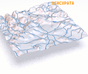 Places with similar names to Ushcupata, Peru :: Disclaimer :: Information on this page comes without warranty of any kind |
||
|
Where is Ushcupata? Elevation and coordinates ::
Latitude (lat): 14°17'54"S Longitude (lon): 71°11'9"W
Elevation (approx.): 3710m (map arrows pan, magnifying glasses zoom) |
||
|
Visiting Ushcupata? Hotel/Accommodation ::
Book a hotel in Ushcupata Travel Guide ::
Buy a travel guide for Peru rental cars ::
car rental offers GPS waypoint ::
download a GPX waypoint (PoI) of Ushcupata for your GPS receiver
|
||