|
search place name
|
||
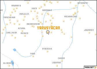
Yarusyacan (Pasco, Peru)Yarusyacan is a town in the Pasco region of Peru. An overview map of the region around Yarusyacan is displayed below.
regional and 3d topo map of Yarusyacan, Peru ::
Yarusyacan airports ::
The nearest airport is LIM - Lima Jorge Chavez Intl, located 196.8 km south west of Yarusyacan.
Other airports nearby include ATA - Anta Comandante Fap German Arias Graziani (199.1 km north west), Nearby towns ::
Hacienda Piquillhuanca (1.4km north east) //
Racche (2.4km west) //
Chauyar (2.7km west) //
Cunaya (3.3km north east) //
Pumachaca (3.3km north west) //
Chaprin (3.5km north east) //
Quiunachacan (3.7km north) //
Acobamba (4.6km north) //
Chacra Colorada (4.9km north west) //
Jarcahuaca (5.2km north) //
Ninao (5.2km east) //
Chinchan (5.2km east) //
Huariaca (5.5km north) //
Huichpín (5.6km north west) //
Caraparac (6.0km east) //
Macarcancha (6.4km north west) //
Fundicíon (6.5km north west) //
Atacocha (6.6km south) //
Huacanuain (6.6km north) //
Jarria (7.0km north west) //
Canish (7.4km north) //
Maraunina (7.7km north west) //
Hacienda Huanacchaca (7.8km north) //
Chunomarca (7.8km north east) //
San Roque (8.2km north) //
Punta (8.4km north) //
La Curva (8.5km north west) //
Umapancuy (8.5km north west) //
Cajamarquilla (8.8km east) //
[all distances 'as the bird flies' and approximate]  Places with similar names to Yarusyacan, Peru :: Disclaimer :: Information on this page comes without warranty of any kind |
||
|
Where is Yarusyacan? Elevation and coordinates ::
Latitude (lat): 10°29'28"S Longitude (lon): 76°11'48"W
Elevation (approx.): 3812m (map arrows pan, magnifying glasses zoom) |
||
|
Visiting Yarusyacan? Hotel/Accommodation ::
Book a hotel in Yarusyacan Travel Guide ::
Buy a travel guide for Peru rental cars ::
car rental offers GPS waypoint ::
download a GPX waypoint (PoI) of Yarusyacan for your GPS receiver
|
||