|
search place name
|
||
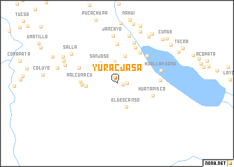
Yuracjasa (Cusco, Peru)Yuracjasa is a town in the Cusco region of Peru. An overview map of the region around Yuracjasa is displayed below.
regional and 3d topo map of Yuracjasa, Peru ::
Yuracjasa airports ::
The nearest airport is CUZ - Cuzco Teniente Alejandro Velasco Astete Intl, located 125.9 km north west of Yuracjasa.
Other airports nearby include JUL - Juliaca (164.4 km south east), AQP - Arequipa Rodriguez Ballon (205.7 km south), Nearby towns ::
Atunhuasi (0.9km east) //
Patactira (0.9km north) //
Pucara (1.6km east) //
Cochucho (2.6km north) //
Colegio (2.9km north west) //
Jantahuasi (3.1km north) //
Catahui (3.6km north) //
El Descanso (4.0km south) //
San José (4.2km north west) //
Pichihua (4.5km north) //
Chilacunca (4.8km west) //
Coricocha (5.4km west) //
Malcunacu (5.6km west) //
Huatapisco (5.9km east) //
Chancarani (6.2km north east) //
Jancahui (6.3km north) //
Quiscayoc Pata (6.4km north east) //
Caballo Pata (6.4km north east) //
Anchuara (6.4km north west) //
Laramani (6.8km east) //
Pertendes (7.0km north) //
Huallahuana (7.2km east) //
Jancayo (7.7km north) //
Pilcurani (7.9km north) //
Salla (8.5km north west) //
Checca (8.6km west) //
Langui (9.0km north east) //
Ccallya (9.1km north east) //
Chilcane (9.0km north west) //
[all distances 'as the bird flies' and approximate] 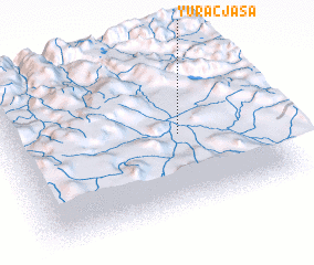 Places with similar names to Yuracjasa, Peru :: Disclaimer :: Information on this page comes without warranty of any kind |
||
|
Where is Yuracjasa? Elevation and coordinates ::
Latitude (lat): 14°29'58"S Longitude (lon): 71°19'7"W
Elevation (approx.): 4118m (map arrows pan, magnifying glasses zoom) |
||
|
Visiting Yuracjasa? Hotel/Accommodation ::
Book a hotel in Yuracjasa Travel Guide ::
Buy a travel guide for Peru rental cars ::
car rental offers GPS waypoint ::
download a GPX waypoint (PoI) of Yuracjasa for your GPS receiver
|
||