|
search place name
|
||
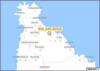
Palha Carga (Cape Verde)Palha Carga is a town in Cape Verde. An overview map of the region around Palha Carga is displayed below.
regional and 3d topo map of Palha Carga, Cape Verde ::
Palha Carga airports ::
The nearest airport is MMO - Maio, located 49.1 km east of Palha Carga.
Other airports nearby include BVC - Boa Vista Rabil (131.6 km north east), SNE - Sao Nocolau Island Preguica (165.6 km north west), SID - Amilcar Cabral Intl (185.4 km north east), VXE - Sao Vicente Island Sao Pedro (232.6 km north west), Nearby towns ::
Chacha (1.9km south) //
Ribeirão Sal (2.6km north west) //
Chã de Dentro (2.6km north west) //
Achada Monte (2.6km north east) //
Mato Correia (2.6km south east) //
Massapé (4.0km north west) //
Ilhéu (4.0km south east) //
Biscainhos (5.2km north west) //
Montinho (5.4km west) //
Achadinha (5.7km west) //
Fundura (6.6km south west) //
Lapa Cachorro (6.6km north west) //
Portal (6.5km north west) //
Moerão (6.5km north west) //
Montão (6.5km north west) //
Chã de Figueiras (6.5km south west) //
Figueira das Naus (8.1km south west) //
Calheta (8.1km south east) //
Pinchossa (9.1km south east) //
[all distances 'as the bird flies' and approximate] 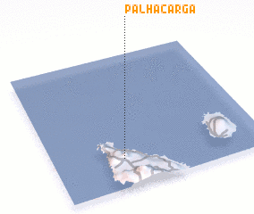 Places with similar names to Palha Carga, Cape Verde :: Disclaimer :: Information on this page comes without warranty of any kind |
||
|
Where is Palha Carga? Elevation and coordinates ::
Latitude (lat): 15°13'0"N Longitude (lon): 23°40'0"W
Elevation (approx.): 321m (map arrows pan, magnifying glasses zoom) |
||
|
Visiting Palha Carga? Hotel/Accommodation ::
Book a hotel in Palha Carga Travel Guide ::
Buy a travel guide for Cape Verde rental cars ::
car rental offers GPS waypoint ::
download a GPX waypoint (PoI) of Palha Carga for your GPS receiver
|
||