|
search place name
|
||
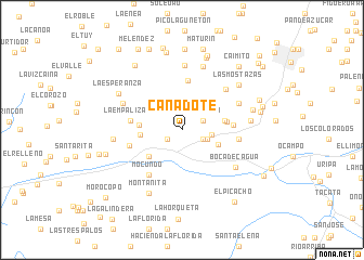
Cañadote (Aragua, Venezuela)Cañadote is a town in the Aragua region of Venezuela. An overview map of the region around Cañadote is displayed below.
regional and 3d topo map of Cañadote, Venezuela ::
Cañadote airports ::
The nearest airport is CCS - Caracas Simon Bolivar Intl, located 39.6 km north east of Cañadote.
Other airports nearby include VLN - Valencia Arturo Michelena Intl (87.9 km west), PBL - Puerto Cabello General Bartolome Salom Intl (105.1 km west), VDP - Valle De La Pascua (171.1 km south east), SFH - San Felipe Sub Teniente Nestor Arias (177.4 km west), Nearby towns ::
Guayas (1.8km south west) //
La Begonia (2.3km north east) //
Las Flores (2.3km south east) //
Jabillar (2.7km east) //
Variante (3.1km east) //
Urbanización Turpial (4.0km south east) //
Barrio Beisbol (4.3km west) //
Las Tejerías (4.3km south west) //
La Peña del Tigre (4.4km west) //
Quebrada de Guayas (4.4km east) //
Quebrada de Guayas (4.6km east) //
La Ermita (5.1km north) //
Guaracarumbo (5.2km east) //
La Empalizada (5.2km west) //
Barrio Leonardo Ruíz Pineda (5.5km west) //
Curiepe (5.7km south west) //
Mocundo (5.7km south west) //
Boquerón (5.8km east) //
Sabaneta (6.1km north east) //
El Encanto (6.4km north east) //
Las Lajas (6.6km north) //
El Limón (6.6km north west) //
Boca de Cagua (6.7km south east) //
Agua Amarilla (6.8km north) //
Puerta Morocha (7.1km east) //
Santo Domingo (7.1km west) //
Conofe (7.3km south west) //
Montañita (7.3km south west) //
La Esperanza (7.4km north west) //
[all distances 'as the bird flies' and approximate] 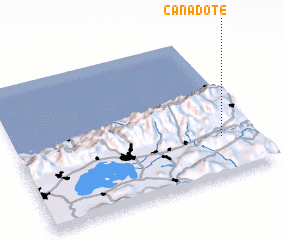 Places with similar names to Cañadote, Venezuela ::
Disclaimer :: Information on this page comes without warranty of any kind |
||
|
Where is Cañadote? Elevation and coordinates ::
Latitude (lat): 10°16'30"N Longitude (lon): 67°8'10"W
Elevation (approx.): 615m (map arrows pan, magnifying glasses zoom) |
||
|
Visiting Cañadote? Hotel/Accommodation ::
Book a hotel in Cañadote Travel Guide ::
Buy a travel guide for Venezuela rental cars ::
car rental offers GPS waypoint ::
download a GPX waypoint (PoI) of Cañadote for your GPS receiver
|
||