|
search place name
|
||
Cumaragua (Lara, Venezuela)Cumaragua is a town in the Lara region of Venezuela. An overview map of the region around Cumaragua is displayed below.
regional and 3d topo map of Cumaragua, Venezuela ::

Cumaragua airports ::
The nearest airport is SFH - San Felipe Sub Teniente Nestor Arias, located 36.0 km east of Cumaragua.
Other airports nearby include BRM - Barquisimeto Intl (51.0 km south west), AGV - Acarigua Oswaldo Guevara Mujica (95.4 km south), PBL - Puerto Cabello General Bartolome Salom Intl (108.6 km east), VLN - Valencia Arturo Michelena Intl (127.1 km east), Nearby towns ::
Campo Solo (1.9km north east) //
Fila Limoncito (1.9km south) //
Casa Amarilla (2.0km north west) //
Barrio Nuevo (2.3km south west) //
El Guayabo (2.3km north east) //
Caraquitas (2.4km north east) //
San Mateo (2.5km north) //
Limoncito (3.2km south) //
Las Taritas (3.4km south) //
El Treinta (3.8km north east) //
El Huso (4.0km north) //
La Glorieta (4.3km south west) //
Agua Fría (4.8km east) //
Los Negritos (5.1km north east) //
Sol y Sombra (5.3km east) //
El Cuarenta (5.6km south west) //
El Tuque (6.1km north east) //
El Tuque (6.5km north east) //
Naranjito (6.8km west) //
Batatal (7.0km south) //
La Florida (7.0km south west) //
La Danta (7.2km south) //
Portachuelo (7.2km south west) //
La Vega (7.4km west) //
Arire (7.6km north west) //
San Pedrito (8.2km west) //
Cayures (8.6km east) //
Cambural (8.9km south west) //
La Zarza (9.2km south west) //
[all distances 'as the bird flies' and approximate] 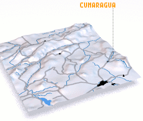 Places with similar names to Cumaragua, Venezuela ::
Disclaimer :: Information on this page comes without warranty of any kind |
||
|
Where is Cumaragua? Elevation and coordinates ::
Latitude (lat): 10°23'52"N Longitude (lon): 69°3'40"W
Elevation (approx.): 724m (map arrows pan, magnifying glasses zoom) |
||
|
Visiting Cumaragua? Hotel/Accommodation ::
Book a hotel in Cumaragua Travel Guide ::
Buy a travel guide for Venezuela rental cars ::
car rental offers GPS waypoint ::
download a GPX waypoint (PoI) of Cumaragua for your GPS receiver
|
||