|
search place name
|
||
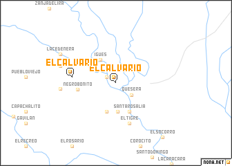
El Calvario (Cojedes, Venezuela)El Calvario is a town in the Cojedes region of Venezuela. An overview map of the region around El Calvario is displayed below.
regional and 3d topo map of El Calvario, Venezuela ::
El Calvario airports ::
The nearest airport is SFD - San Fernando De Apure, located 97.8 km south east of El Calvario.
Other airports nearby include AGV - Acarigua Oswaldo Guevara Mujica (173.1 km north west), VLN - Valencia Arturo Michelena Intl (178.3 km north), GUQ - Guanare (196.6 km west), SFH - San Felipe Sub Teniente Nestor Arias (207.7 km north), Nearby towns ::
Guadarrama (1.8km north west) //
Boca de Perro (2.6km north west) //
Quesera (3.2km south east) //
Las Trincheras (4.3km north west) //
Igüés (4.4km north west) //
Manga Letrera (4.6km south) //
El Pao (4.9km south) //
Santa Rosalía (5.1km south east) //
Negro Bonito (6.2km west) //
El Tigre (6.8km south) //
El Calvario (7.1km west) //
El Socorro (11.5km south east) //
[all distances 'as the bird flies' and approximate] 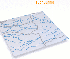 Places with similar names to El Calvario, Venezuela ::
// El Calvario (PA)
// El Calvario (PA)
// El Calvario (PA)
// El Calvario (CU)
// El Calvario (CU)
// El Calvario (ES)
// El Calvario (CL)
// El Calvario (CO)
// El Calvario (CO)
// El Calvario (CO)
Disclaimer :: Information on this page comes without warranty of any kind |
||
|
Where is El Calvario? Elevation and coordinates ::
Latitude (lat): 8°32'30"N Longitude (lon): 68°2'10"W
Elevation (approx.): 54m (map arrows pan, magnifying glasses zoom) |
||
|
Visiting El Calvario? Hotel/Accommodation ::
Book a hotel in El Calvario Travel Guide ::
Buy a travel guide for Venezuela rental cars ::
car rental offers GPS waypoint ::
download a GPX waypoint (PoI) of El Calvario for your GPS receiver
|
||