|
search place name
|
||
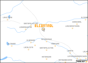
El Control (Apure, Venezuela)El Control is a town in the Apure region of Venezuela. An overview map of the region around El Control is displayed below.
regional and 3d topo map of El Control, Venezuela ::
El Control airports ::
The nearest airport is AUC - Arauca Santiago Perez, located 92.9 km west of El Control.
Other airports nearby include BNS - Barinas (158.4 km north), GUQ - Guanare (200.4 km north), MRD - Merida Alberto Carnevalli (204.2 km north west), TME - Tame (221.6 km south west), Nearby towns ::
Mata de Canoa (2.2km north west) //
Mata de Indio (4.3km south) //
Santa Feliícitas (6.1km north west) //
El Charal (6.9km south west) //
El Bramón (7.3km south west) //
Tabacare (7.7km south east) //
Los Araguatos (7.8km west) //
Santa Felícitas (8.0km south) //
La Calceta (10.0km south west) //
[all distances 'as the bird flies' and approximate]  Places with similar names to El Control, Venezuela ::
// El Control (CO)
// El Control (MX)
Disclaimer :: Information on this page comes without warranty of any kind |
||
|
Where is El Control? Elevation and coordinates ::
Latitude (lat): 7°13'16"N Longitude (lon): 69°54'34"W
Elevation (approx.): 103m (map arrows pan, magnifying glasses zoom) |
||
|
Visiting El Control? Hotel/Accommodation ::
Book a hotel in El Control Travel Guide ::
Buy a travel guide for Venezuela rental cars ::
car rental offers GPS waypoint ::
download a GPX waypoint (PoI) of El Control for your GPS receiver
|
||