|
search place name
|
||
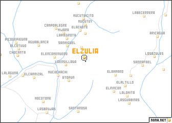
El Zulia (Mérida, Venezuela)El Zulia is a town in the Mérida region of Venezuela. An overview map of the region around El Zulia is displayed below.
regional and 3d topo map of El Zulia, Venezuela ::
El Zulia airports ::
The nearest airport is MRD - Merida Alberto Carnevalli, located 46.8 km north of El Zulia.
Other airports nearby include STD - Santo Domingo Mayor Buenaventura Vivas (107.0 km south west), LFR - La Fria (109.0 km west), STB - Santa Barbara Del Zulia (114.2 km north west), BNS - Barinas (126.9 km north east), Nearby towns ::
Mucucharaní (3.1km north) //
La Ensillada (4.4km west) //
San Miguel (5.2km north west) //
Otopún (5.6km south west) //
Mucurisa (6.1km north) //
La Piedrota (6.4km north west) //
Mucuchachí (6.7km south west) //
El Achote (6.8km north) //
El Encomendero (6.8km west) //
El Amparo (7.1km south east) //
Mijará (7.8km north west) //
Mucutuy (8.0km north) //
El Rincón (8.9km south east) //
Campo Alegre (9.6km north west) //
El Altillo (10.0km south east) //
[all distances 'as the bird flies' and approximate]  Places with similar names to El Zulia, Venezuela ::
Disclaimer :: Information on this page comes without warranty of any kind |
||
|
Where is El Zulia? Elevation and coordinates ::
Latitude (lat): 8°10'38"N Longitude (lon): 71°17'2"W
Elevation (approx.): 2130m (map arrows pan, magnifying glasses zoom) |
||
|
Visiting El Zulia? Hotel/Accommodation ::
Book a hotel in El Zulia Travel Guide ::
Buy a travel guide for Venezuela rental cars ::
car rental offers GPS waypoint ::
download a GPX waypoint (PoI) of El Zulia for your GPS receiver
|
||