|
search place name
|
||
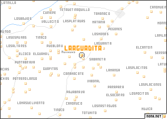
La Aguadita (Cojedes, Venezuela)La Aguadita is a town in the Cojedes region of Venezuela. An overview map of the region around La Aguadita is displayed below.
regional and 3d topo map of La Aguadita, Venezuela ::
La Aguadita airports ::
The nearest airport is VLN - Valencia Arturo Michelena Intl, located 62.1 km north east of La Aguadita.
Other airports nearby include SFH - San Felipe Sub Teniente Nestor Arias (65.5 km north west), PBL - Puerto Cabello General Bartolome Salom Intl (81.0 km north east), AGV - Acarigua Oswaldo Guevara Mujica (98.2 km west), BRM - Barquisimeto Intl (109.9 km west), Nearby towns ::
Macanilla (0.2km north) //
Trapachito (1.7km south) //
El Jabillo (2.2km south west) //
Las Matas (2.5km south west) //
Las Palmas (3.0km south east) //
Monagas (3.2km west) //
Sabaneta (3.5km east) //
Rincón de Los Toros (4.0km south east) //
Piedras Pintadas (4.2km south east) //
Potrerito (4.2km west) //
Los Leoncitos (4.5km north) //
Caramacate (4.8km south west) //
La Guamita (5.2km north east) //
Macapo (5.7km west) //
Pueblo Nuevo (5.9km west) //
Los Monos (6.1km north east) //
Viboral (6.5km south east) //
Cartanal (6.6km south west) //
Caja de Agua (7.1km north) //
El Rincón (7.4km west) //
La Centella (7.4km west) //
La Manga (7.6km south east) //
Pueblo de Paja (7.6km west) //
Las Platadas (7.8km north) //
Las Mesas (7.8km north) //
Guafitas (7.7km south west) //
Mataria (8.1km north east) //
Quebrada Arriba (8.2km south west) //
El Tamarindo (8.3km north west) //
[all distances 'as the bird flies' and approximate]  Places with similar names to La Aguadita, Venezuela ::
// Lagatit (PH)
// La Caduta (IT)
// La Aguadita (CU)
// La Aguadita (CO)
// La Aguadita (CO)
// La Aguadita (CO)
// Lokodidi (ID)
// Lokitete (UG)
// Lokudet (UG)
// La Aguadita (VE)
Disclaimer :: Information on this page comes without warranty of any kind |
||
|
Where is La Aguadita? Elevation and coordinates ::
Latitude (lat): 9°48'55"N Longitude (lon): 68°22'58"W
Elevation (approx.): 296m (map arrows pan, magnifying glasses zoom) |
||
|
Visiting La Aguadita? Hotel/Accommodation ::
Book a hotel in La Aguadita Travel Guide ::
Buy a travel guide for Venezuela rental cars ::
car rental offers GPS waypoint ::
download a GPX waypoint (PoI) of La Aguadita for your GPS receiver
|
||