|
search place name
|
||
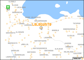
La Lagunita (Carabobo, Venezuela)La Lagunita is a town in the Carabobo region of Venezuela. An overview map of the region around La Lagunita is displayed below.
regional and 3d topo map of La Lagunita, Venezuela ::
La Lagunita airports ::
The nearest airport is VLN - Valencia Arturo Michelena Intl, located 18.1 km north west of La Lagunita.
Other airports nearby include PBL - Puerto Cabello General Bartolome Salom Intl (56.0 km north west), CCS - Caracas Simon Bolivar Intl (106.5 km north east), SFH - San Felipe Sub Teniente Nestor Arias (108.3 km west), AGV - Acarigua Oswaldo Guevara Mujica (168.1 km west), Nearby towns ::
El Piñal (1.1km south) //
Aragüita (2.0km south west) //
El Venado (2.5km north) //
El Trompillo (2.7km east) //
El Hatico (2.8km north west) //
Peñitas (2.9km south) //
Pedernales (2.9km south east) //
Adjuntas (2.9km east) //
Pedernales (3.0km south east) //
La Marucha (3.1km north east) //
San Juan de Dios (3.2km north) //
Güigüe (3.4km north east) //
La Palma (3.5km south) //
Las Cañadas (3.9km north west) //
Panecito (4.2km north east) //
Las Colonias (4.4km south east) //
El Copey (4.9km north east) //
La Sapera (5.1km south east) //
Valdespino (5.4km north west) //
Corocito (5.5km north west) //
Caicara (5.5km south east) //
Santa Efigenia (5.8km south) //
Cogollal (5.8km west) //
Altamira (5.9km south) //
Las Vegas (5.9km south east) //
La Represa (6.0km west) //
Amapola (6.0km east) //
Agua Blanca (6.4km west) //
Cecilia (6.5km south) //
[all distances 'as the bird flies' and approximate]  Places with similar names to La Lagunita, Venezuela ::
// Lilkendey (DE)
// La Lagunita (PA)
// Luli Kāndi (BD)
// Liligondé (BF)
// Liligonndé (BF)
// La Lagunita (CO)
// La Lagunita (CO)
// Lolekunda (CD)
// La Laguneta (SV)
// La Laguneta (SV)
Disclaimer :: Information on this page comes without warranty of any kind |
||
|
Where is La Lagunita? Elevation and coordinates ::
Latitude (lat): 10°3'28"N Longitude (lon): 67°47'31"W
Elevation (approx.): 520m (map arrows pan, magnifying glasses zoom) |
||
|
Visiting La Lagunita? Hotel/Accommodation ::
Book a hotel in La Lagunita Travel Guide ::
Buy a travel guide for Venezuela rental cars ::
car rental offers GPS waypoint ::
download a GPX waypoint (PoI) of La Lagunita for your GPS receiver
|
||