|
search place name
|
||
Las Dolores (Aragua, Venezuela)Las Dolores is a town in the Aragua region of Venezuela. An overview map of the region around Las Dolores is displayed below.
regional and 3d topo map of Las Dolores, Venezuela ::

Las Dolores airports ::
The nearest airport is CCS - Caracas Simon Bolivar Intl, located 55.6 km north of Las Dolores.
Other airports nearby include VLN - Valencia Arturo Michelena Intl (90.6 km west), PBL - Puerto Cabello General Bartolome Salom Intl (113.8 km west), VDP - Valle De La Pascua (156.6 km south east), SFH - San Felipe Sub Teniente Nestor Arias (182.0 km west), Nearby towns ::
Hacienda La Lagunita (2.1km south west) //
Raboncito (2.7km west) //
La Emilia (2.7km east) //
Los Tres Palos (2.8km east) //
El Amparo (3.1km north east) //
El Carmen (3.1km north east) //
La Caña Amarga (3.2km north east) //
Campo Elias (3.6km east) //
Rabón (3.8km south west) //
Las Delicias (4.0km north east) //
La Laguna (4.0km east) //
La Unión (4.5km north east) //
El Trompillo (4.7km south) //
Tiarita (4.9km north west) //
El Guásimo (5.2km south east) //
El Castaño (5.2km west) //
El Bagre (5.3km east) //
Santa Rosalía (5.6km north west) //
Tiara (5.6km north west) //
Valladolid (5.9km south) //
Curazao (5.9km north east) //
Bucares (6.1km south west) //
Altagracia (6.2km east) //
Santa Elena (6.3km north) //
Los Paraparos (6.3km south west) //
El Altar (6.5km south) //
El Pegón (6.7km north east) //
Hacienda La Lagunilla (7.0km west) //
Los Ranchos (7.1km south west) //
[all distances 'as the bird flies' and approximate] 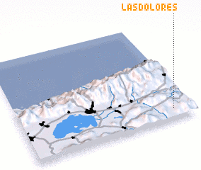 Places with similar names to Las Dolores, Venezuela ::
// Las Dolores (CU)
// Los Dolores (CU)
// Los Dolores (ES)
// Los Dolores (ES)
// Los Dolores (GT)
// Los Dolores (MX)
// Los Dolores (MX)
// Los Dolores (MX)
// Los Dolores (MX)
// Los Dolores (MX)
Disclaimer :: Information on this page comes without warranty of any kind |
||
|
Where is Las Dolores? Elevation and coordinates ::
Latitude (lat): 10°6'48"N Longitude (lon): 67°6'10"W
Elevation (approx.): 747m (map arrows pan, magnifying glasses zoom) |
||
|
Visiting Las Dolores? Hotel/Accommodation ::
Book a hotel in Las Dolores Travel Guide ::
Buy a travel guide for Venezuela rental cars ::
car rental offers GPS waypoint ::
download a GPX waypoint (PoI) of Las Dolores for your GPS receiver
|
||