|
search place name
|
||
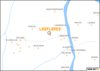
Las Flores (Bolívar, Venezuela)Las Flores is a town in the Bolívar region of Venezuela. An overview map of the region around Las Flores is displayed below.
regional and 3d topo map of Las Flores, Venezuela ::
Las Flores airports ::
The nearest airport is CBL - Ciudad Bolivar, located 201.4 km east of Las Flores.
Other airports nearby include SOM - San Tome (204.0 km north east), VDP - Valle De La Pascua (213.2 km north west), AAO - Anaco (234.7 km north), Nearby towns ::
Cucurital (4.4km east) //
Chaparrito (4.9km north east) //
La Quesera (5.4km east) //
La Colmena (6.5km south west) //
Terecay (7.2km west) //
El Puente (8.4km south east) //
La Broma (8.9km south west) //
El Cambur (9.2km south east) //
Palancón (9.7km south east) //
[all distances 'as the bird flies' and approximate] 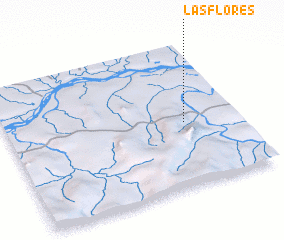 Places with similar names to Las Flores, Venezuela ::
// Las Flores (US)
// Las Flores (US)
// Las Flores (US)
// Las Flores (US)
// Las Flores (PA)
// Las Flores (PA)
// Las Flores (PA)
// Las Flores (PA)
// Las Flores (PA)
// Las Flores (PA)
Disclaimer :: Information on this page comes without warranty of any kind |
||
|
Where is Las Flores? Elevation and coordinates ::
Latitude (lat): 7°26'56"N Longitude (lon): 65°14'2"W
Elevation (approx.): 30m (map arrows pan, magnifying glasses zoom) |
||
|
Visiting Las Flores? Hotel/Accommodation ::
Book a hotel in Las Flores Travel Guide ::
Buy a travel guide for Venezuela rental cars ::
car rental offers GPS waypoint ::
download a GPX waypoint (PoI) of Las Flores for your GPS receiver
|
||