|
search place name
|
||
Los Caobos (Distrito Federal, Venezuela)Los Caobos is a town in the Distrito Federal region of Venezuela. An overview map of the region around Los Caobos is displayed below.
regional and 3d topo map of Los Caobos, Venezuela ::

Los Caobos airports ::
The nearest airport is CCS - Caracas Simon Bolivar Intl, located 15.1 km north west of Los Caobos.
Other airports nearby include VLN - Valencia Arturo Michelena Intl (119.1 km west), PBL - Puerto Cabello General Bartolome Salom Intl (128.4 km west), VDP - Valle De La Pascua (172.8 km south east), SFH - San Felipe Sub Teniente Nestor Arias (204.6 km west), Nearby towns ::
San Agustín (1.2km west) //
Las Acacias (1.2km south) //
El Silencio (1.8km west) //
Caracas (1.8km west) //
Sarria (1.9km north) //
Mariperez (1.8km east) //
El Recreo (1.8km east) //
Los Chaguaramos (2.0km south east) //
Prado de María (2.1km south west) //
Colinas de Santa Monica (2.1km south east) //
Buenos Aires (2.6km south west) //
Puerta Caracas (2.6km north west) //
Sabana Grande (2.8km east) //
La Planicie (3.1km north west) //
Colinas de Bello Monte (3.1km south east) //
Los Marciales (3.7km south) //
Las Queseritas (3.7km north) //
La Pastora (3.7km north) //
La Florida (3.6km east) //
La Pastora (3.7km north west) //
El Paraíso (3.8km west) //
Country Club (4.0km east) //
San Chorquiz (4.1km north west) //
Cumare (4.1km north west) //
Los Castillitos (4.1km north west) //
Veintitres de Enero (4.1km west) //
Los Campitos (4.4km south east) //
Los Mecedores (4.5km north east) //
Carangano (4.5km south west) //
[all distances 'as the bird flies' and approximate] 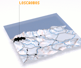 Places with similar names to Los Caobos, Venezuela ::
// Las Guabas (PA)
// Las Guabas (PA)
// Las Guabas (PA)
// Los Guabos (PA)
// Los Guabos (PA)
// Los Cabos (ES)
// Las Guabas (EC)
// Los Cubes (GT)
// Las Cubes (MX)
// Las Cuibas (VE)
Disclaimer :: Information on this page comes without warranty of any kind |
||
|
Where is Los Caobos? Elevation and coordinates ::
Latitude (lat): 10°30'0"N Longitude (lon): 66°54'0"W
Elevation (approx.): 884m (map arrows pan, magnifying glasses zoom) |
||
|
Visiting Los Caobos? Hotel/Accommodation ::
Book a hotel in Los Caobos Travel Guide ::
Buy a travel guide for Venezuela rental cars ::
car rental offers GPS waypoint ::
download a GPX waypoint (PoI) of Los Caobos for your GPS receiver
|
||