|
search place name
|
||
Los Flores (Estado Vargas, Venezuela)Los Flores is a town in the Estado Vargas region of Venezuela. An overview map of the region around Los Flores is displayed below.
regional and 3d topo map of Los Flores, Venezuela ::

Los Flores airports ::
The nearest airport is CCS - Caracas Simon Bolivar Intl, located 13.1 km north west of Los Flores.
Other airports nearby include VLN - Valencia Arturo Michelena Intl (122.7 km west), PBL - Puerto Cabello General Bartolome Salom Intl (130.5 km west), VDP - Valle De La Pascua (176.3 km south east), SFH - San Felipe Sub Teniente Nestor Arias (207.2 km west), Nearby towns ::
Los Cedros (0.5km north) //
Helechal (0.9km west) //
Capuchinos (0.9km west) //
Boquerón (1.8km east) //
Los Venados (1.8km west) //
Los Asientos (1.9km west) //
Los Mecedores (2.2km south east) //
El Infiernito (2.6km north west) //
La Pastora (2.6km south west) //
Las Queseritas (2.6km south west) //
La Montaña (3.7km north) //
El Infiernito (3.9km west) //
San José de Galipán (4.1km north west) //
Sarria (4.1km south west) //
Loma Redonda (4.1km north east) //
Palmar de Caridad (4.1km north west) //
Los Castillitos (4.1km south west) //
Cumare (4.1km south west) //
San Chorquiz (4.1km south west) //
Hacienda Santa Rita (4.1km north west) //
El Carmelo (4.2km north west) //
El Palmar de Cariaco (4.3km north west) //
La Planicie (4.6km north) //
Conejo Blanco (4.6km west) //
Las Canoas (5.0km west) //
Cariaco (5.2km north west) //
Puerta Caracas (5.2km south west) //
El Palmar (5.2km west) //
Lagunita (5.3km north) //
[all distances 'as the bird flies' and approximate] 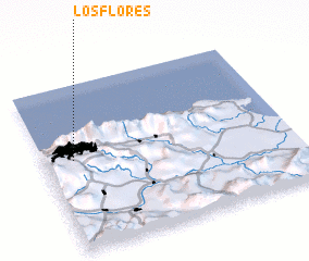 Places with similar names to Los Flores, Venezuela ::
// Las Flores (US)
// Las Flores (US)
// Las Flores (US)
// Las Flores (US)
// Las Flores (PA)
// Las Flores (PA)
// Las Flores (PA)
// Las Flores (PA)
// Las Flores (PA)
// Las Flores (PA)
Disclaimer :: Information on this page comes without warranty of any kind |
||
|
Where is Los Flores? Elevation and coordinates ::
Latitude (lat): 10°33'0"N Longitude (lon): 66°53'0"W
Elevation (approx.): 1603m (map arrows pan, magnifying glasses zoom) |
||
|
Visiting Los Flores? Hotel/Accommodation ::
Book a hotel in Los Flores Travel Guide ::
Buy a travel guide for Venezuela rental cars ::
car rental offers GPS waypoint ::
download a GPX waypoint (PoI) of Los Flores for your GPS receiver
|
||