|
search place name
|
||
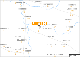
Los Yesos (Anzoátegui, Venezuela)Los Yesos is a town in the Anzoátegui region of Venezuela. An overview map of the region around Los Yesos is displayed below.
regional and 3d topo map of Los Yesos, Venezuela ::
Los Yesos airports ::
The nearest airport is BLA - Barcelona General Jose Antonio Anzoategui Intl, located 37.2 km north west of Los Yesos.
Other airports nearby include AAO - Anaco (45.5 km south), CUM - Cumana Antonio Jose De Sucre (77.5 km north east), SOM - San Tome (105.6 km south), PMV - Porlamar Del Caribe Intl Gen Santiago Marino (131.1 km north east), Nearby towns ::
Potrerito (1.3km south west) //
El Potrero (3.5km east) //
El Mongo (5.7km south east) //
Quebrajachal (6.8km east) //
La Trinchera (6.9km north west) //
Sánchez (6.9km south east) //
Aragua (7.1km east) //
Quiamare (7.4km north west) //
Santa Catalina (7.7km west) //
El Ladrillo (9.8km south east) //
Bello Monte (10.5km south west) //
La Mota (10.7km north west) //
La Fundación (11.3km north west) //
[all distances 'as the bird flies' and approximate] 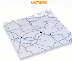
Disclaimer :: Information on this page comes without warranty of any kind |
||
|
Where is Los Yesos? Elevation and coordinates ::
Latitude (lat): 9°50'30"N Longitude (lon): 64°28'50"W
Elevation (approx.): 105m (map arrows pan, magnifying glasses zoom) |
||
|
Visiting Los Yesos? Hotel/Accommodation ::
Book a hotel in Los Yesos Travel Guide ::
Buy a travel guide for Venezuela rental cars ::
car rental offers GPS waypoint ::
download a GPX waypoint (PoI) of Los Yesos for your GPS receiver
|
||