|
search place name
|
||
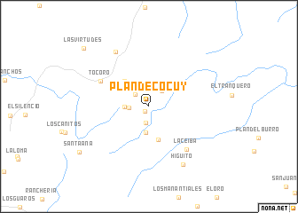
Plan de Cocuy (Lara, Venezuela)Plan de Cocuy is a town in the Lara region of Venezuela. An overview map of the region around Plan de Cocuy is displayed below.
regional and 3d topo map of Plan de Cocuy, Venezuela ::
Plan de Cocuy airports ::
The nearest airport is BRM - Barquisimeto Intl, located 122.0 km south east of Plan de Cocuy.
Other airports nearby include CZE - Coro Jose Leonardo Chirinos (123.7 km north east), VLV - Valera Dr Antonio Nicolas Briceno (132.9 km south), LSP - Paraguana Josefa Camejo (141.2 km north), MAR - Maracaibo La Chinita Intl (149.5 km west), Nearby towns ::
El Hondo (0.8km south west) //
Turupialto (2.1km south) //
La Peña de la Virgen (2.3km north west) //
El Hatico (2.5km west) //
Juan de Mata (2.5km north east) //
El Hatico (3.0km west) //
La Ceiba (3.4km south) //
Plan de Febrero (4.4km south) //
Pie del Cerro (4.4km north west) //
Tocoro (6.7km north west) //
La Ceiba (7.2km south east) //
La Gallina (8.0km north west) //
Higuito (8.4km south east) //
Santa Ana (10.4km south west) //
Las Virtudes (10.9km north west) //
[all distances 'as the bird flies' and approximate] 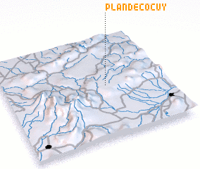 Places with similar names to Plan de Cocuy, Venezuela :: Disclaimer :: Information on this page comes without warranty of any kind |
||
|
Where is Plan de Cocuy? Elevation and coordinates ::
Latitude (lat): 10°31'18"N Longitude (lon): 70°21'44"W
Elevation (approx.): 888m (map arrows pan, magnifying glasses zoom) |
||
|
Visiting Plan de Cocuy? Hotel/Accommodation ::
Book a hotel in Plan de Cocuy Travel Guide ::
Buy a travel guide for Venezuela rental cars ::
car rental offers GPS waypoint ::
download a GPX waypoint (PoI) of Plan de Cocuy for your GPS receiver
|
||