|
search place name
|
||
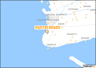
Punta Cardón (Falcón, Venezuela)Punta Cardón is a town in the Falcón region of Venezuela. An overview map of the region around Punta Cardón is displayed below.
regional and 3d topo map of Punta Cardón, Venezuela ::
Punta Cardón airports ::
The nearest airport is LSP - Paraguana Josefa Camejo, located 15.2 km north east of Punta Cardón.
Other airports nearby include CZE - Coro Jose Leonardo Chirinos (64.1 km south east), AUA - Oranjestad Reina Beatrix Intl (95.8 km north), CUR - Willemstad Hato (148.8 km north east), BRM - Barquisimeto Intl (201.7 km south east), Nearby towns ::
Cardón (1.9km north east) //
Manaure (2.6km east) //
Barrio Andrés Eloy Blanco (3.3km north east) //
Urbanización Altamira (4.4km north) //
Carirubana (4.5km north) //
Punto Fijo (4.9km north) //
La Concha (5.5km south) //
La Punta (5.8km south) //
Savino (6.0km north east) //
Las Piedras (6.5km north) //
Las Salinas (6.5km north) //
Barrio Miramar (6.7km north) //
Caja de Agua (6.7km north) //
El Carmelo (8.4km north east) //
Guaranaro (8.5km north east) //
Tiguadare (9.0km south east) //
San Ramón (8.9km east) //
[all distances 'as the bird flies' and approximate] 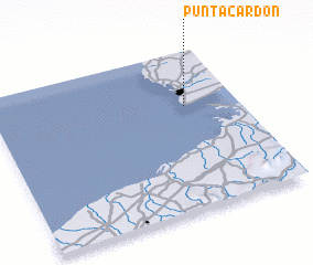 Places with similar names to Punta Cardón, Venezuela ::
// Ponte Gardena (IT)
Disclaimer :: Information on this page comes without warranty of any kind |
||
|
Where is Punta Cardón? Elevation and coordinates ::
Latitude (lat): 11°39'29"N Longitude (lon): 70°12'54"W
Elevation (approx.): 33m (map arrows pan, magnifying glasses zoom) |
||
|
Visiting Punta Cardón? Hotel/Accommodation ::
Book a hotel in Punta Cardón Travel Guide ::
Buy a travel guide for Venezuela rental cars ::
car rental offers GPS waypoint ::
download a GPX waypoint (PoI) of Punta Cardón for your GPS receiver
|
||