|
search place name
|
||
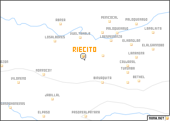
Riecito (Apure, Venezuela)Riecito is a town in the Apure region of Venezuela. An overview map of the region around Riecito is displayed below.
regional and 3d topo map of Riecito, Venezuela ::
Riecito airports ::
The nearest airport is SFD - San Fernando De Apure, located 51.1 km east of Riecito.
Other airports nearby include PCR - Puerto Carreno (185.4 km south), AGV - Acarigua Oswaldo Guevara Mujica (242.4 km north west), GUQ - Guanare (244.5 km north west), VDP - Valle De La Pascua (261.7 km north east), Nearby towns ::
El Caral (4.1km east) //
Vuelta Mala (5.2km north) //
Biruaquita (6.2km south east) //
La Esperanza (7.2km north east) //
La Reforma (7.3km north east) //
Los Albores (7.9km north west) //
Palo Quemado (9.3km north east) //
Abrea (9.7km north west) //
Pericocal (10.2km north east) //
Jabillal (11.2km south west) //
[all distances 'as the bird flies' and approximate] 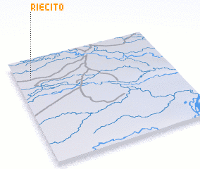 Places with similar names to Riecito, Venezuela ::
Disclaimer :: Information on this page comes without warranty of any kind |
||
|
Where is Riecito? Elevation and coordinates ::
Latitude (lat): 7°48'38"N Longitude (lon): 67°54'6"W
Elevation (approx.): 61m (map arrows pan, magnifying glasses zoom) |
||
|
Visiting Riecito? Hotel/Accommodation ::
Book a hotel in Riecito Travel Guide ::
Buy a travel guide for Venezuela rental cars ::
car rental offers GPS waypoint ::
download a GPX waypoint (PoI) of Riecito for your GPS receiver
|
||