|
search place name
|
||
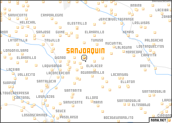
San Joaquín (Miranda, Venezuela)San Joaquín is a town in the Miranda region of Venezuela. An overview map of the region around San Joaquín is displayed below.
regional and 3d topo map of San Joaquín, Venezuela ::
San Joaquín airports ::
The nearest airport is CCS - Caracas Simon Bolivar Intl, located 52.6 km north west of San Joaquín.
Other airports nearby include VDP - Valle De La Pascua (140.5 km south east), VLN - Valencia Arturo Michelena Intl (149.0 km west), PBL - Puerto Cabello General Bartolome Salom Intl (163.8 km west), BLA - Barcelona General Jose Antonio Anzoategui Intl (209.3 km east), Nearby towns ::
Moca (1.3km west) //
La Cabrera (1.6km south west) //
San José (1.8km east) //
El Palmar (2.4km west) //
La Chivera (2.5km west) //
Oficina San Antonio (2.6km south east) //
El Placer (2.6km south east) //
La Moca (2.6km north west) //
El Placer (2.6km south west) //
Buena Vista (2.8km north west) //
Agua Amarilla (3.6km south east) //
Las Américas (3.6km west) //
El Chimborazo (3.6km west) //
Macanilla (3.7km east) //
Cantarrana (3.9km west) //
Los Vegotes (4.0km north) //
La Concepción (4.1km south west) //
Oficina Cantarrana (4.1km south west) //
Quebrada Seca (4.2km south) //
Tumuso (4.4km north east) //
Abreu (5.1km south east) //
Quebrada Seca (5.4km south west) //
Dignao (5.5km west) //
El Estrallo (5.6km north) //
Los Cucharones (5.7km east) //
El Amarillo (5.9km north) //
Bucara (5.9km north) //
Pichaíto (5.8km west) //
Güere Güere (6.1km south west) //
[all distances 'as the bird flies' and approximate] 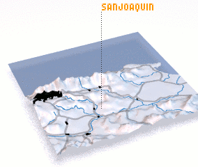 Places with similar names to San Joaquín, Venezuela ::
// San Joaquin (BZ)
// San Joaquin (US)
// San Joaquín (PA)
// San Joaquín (CU)
// San Joaquín (CU)
// San Joaquín (CU)
// San Joaquín (CU)
// San Joaquín (CU)
// San Joaquín (CU)
// San Joaquín (CU)
Disclaimer :: Information on this page comes without warranty of any kind |
||
|
Where is San Joaquín? Elevation and coordinates ::
Latitude (lat): 10°21'0"N Longitude (lon): 66°35'0"W
Elevation (approx.): 255m (map arrows pan, magnifying glasses zoom) |
||
|
Visiting San Joaquín? Hotel/Accommodation ::
Book a hotel in San Joaquín Travel Guide ::
Buy a travel guide for Venezuela rental cars ::
car rental offers GPS waypoint ::
download a GPX waypoint (PoI) of San Joaquín for your GPS receiver
|
||