|
search place name
|
||
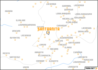
Santa Anita (Falcón, Venezuela)Santa Anita is a town in the Falcón region of Venezuela. An overview map of the region around Santa Anita is displayed below.
regional and 3d topo map of Santa Anita, Venezuela ::
Santa Anita airports ::
The nearest airport is CZE - Coro Jose Leonardo Chirinos, located 29.5 km north of Santa Anita.
Other airports nearby include LSP - Paraguana Josefa Camejo (84.4 km north west), BRM - Barquisimeto Intl (128.6 km south), CUR - Willemstad Hato (141.5 km north east), SFH - San Felipe Sub Teniente Nestor Arias (142.7 km south east), Nearby towns ::
El Mamón (1.6km west) //
La Sabanita (1.8km south) //
Piedra Preñada (1.8km south west) //
La Providencia (2.6km north east) //
Quitaragua (3.2km south east) //
Socopo (3.8km north west) //
Carrizalito (4.0km west) //
San José (4.1km south east) //
La Guarabita (4.4km south) //
San Lorenzo (4.4km north west) //
Cucaide (4.6km south west) //
San Luis (4.9km south east) //
La Ciénega (4.9km east) //
La Peña (5.1km south west) //
Las Masas (5.2km south east) //
El Cruce (5.3km south) //
Curimagua (5.6km north east) //
Francisquito (5.9km south west) //
Macuare (6.5km south) //
El Desengaño (6.9km east) //
Julianote (7.1km south) //
Macuca (7.0km south east) //
Goacoita (7.0km east) //
La Meseta (7.3km south east) //
Catalina (7.5km east) //
El Trapichito (8.1km north east) //
Mapurita (8.3km south west) //
La Cumbre (8.3km north east) //
Zazárida (8.4km east) //
[all distances 'as the bird flies' and approximate]  Places with similar names to Santa Anita, Venezuela ::
// Santa Anita (BR)
// Santa Anita (US)
// San Donato (IT)
// San Donato (IT)
// San Donato (IT)
// San Donato (IT)
// San Donato (IT)
// San Donato (IT)
// San Donato (IT)
// San Donato (IT)
Disclaimer :: Information on this page comes without warranty of any kind |
||
|
Where is Santa Anita? Elevation and coordinates ::
Latitude (lat): 11°9'0"N Longitude (lon): 69°43'0"W
Elevation (approx.): 1193m (map arrows pan, magnifying glasses zoom) |
||
|
Visiting Santa Anita? Hotel/Accommodation ::
Book a hotel in Santa Anita Travel Guide ::
Buy a travel guide for Venezuela rental cars ::
car rental offers GPS waypoint ::
download a GPX waypoint (PoI) of Santa Anita for your GPS receiver
|
||