|
search place name
|
||
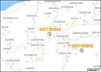
Santa Rosa (Falcón, Venezuela)Santa Rosa is a town in the Falcón region of Venezuela. An overview map of the region around Santa Rosa is displayed below.
regional and 3d topo map of Santa Rosa, Venezuela ::
Santa Rosa airports ::
The nearest airport is LSP - Paraguana Josefa Camejo, located 65.4 km north of Santa Rosa.
Other airports nearby include CZE - Coro Jose Leonardo Chirinos (68.1 km east), AUA - Oranjestad Reina Beatrix Intl (146.5 km north), BRM - Barquisimeto Intl (162.1 km south east), MAR - Maracaibo La Chinita Intl (174.9 km south west), Nearby towns ::
La Ventolina (0.8km south west) //
Urumaco (1.2km east) //
El Paso (2.8km north east) //
El Casino (3.2km north east) //
Juncalito (3.3km south east) //
El Mamón (3.6km north) //
El Hatillo (4.0km north east) //
El Llanito (4.1km north east) //
San Lorenzo (4.7km east) //
Llano Grande (5.3km south west) //
Capirote (5.4km east) //
El Refugio (5.5km north east) //
La Pastora (5.6km south east) //
Playa Larga (5.6km west) //
Las Adjuntas (5.7km south west) //
El Solitario (6.2km south east) //
Los Taques (6.3km south) //
Monte Bello (6.4km south east) //
El Llanito (6.4km west) //
Las Playitas (6.4km south west) //
La Rosita (6.9km south) //
Garcia (7.1km west) //
EL Jebe (7.4km north) //
El Picacho (7.4km north east) //
Corubo (7.7km west) //
El Mayal (8.6km north east) //
El Curari (8.7km west) //
Culebra (9.3km south) //
Corralito (9.2km north west) //
[all distances 'as the bird flies' and approximate]  Places with similar names to Santa Rosa, Venezuela ::
// Sania Torres (MA)
// Santa Rosa (BR)
// Santa Rosa (BR)
// Santa Rosa (BR)
// Santa Rosa (BR)
// Santa Rosa (BR)
// Santa Rosa (BR)
// Santa Rosa (BR)
// Santa Rosa (BR)
// Santa Rosa (BR)
Disclaimer :: Information on this page comes without warranty of any kind |
||
|
Where is Santa Rosa? Elevation and coordinates ::
Latitude (lat): 11°12'3"N Longitude (lon): 70°16'0"W
Elevation (approx.): 71m (map arrows pan, magnifying glasses zoom) |
||
|
Visiting Santa Rosa? Hotel/Accommodation ::
Book a hotel in Santa Rosa Travel Guide ::
Buy a travel guide for Venezuela rental cars ::
car rental offers GPS waypoint ::
download a GPX waypoint (PoI) of Santa Rosa for your GPS receiver
|
||