|
search place name
|
||
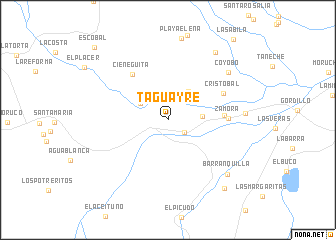
Taguayre (Lara, Venezuela)Taguayre is a town in the Lara region of Venezuela. An overview map of the region around Taguayre is displayed below.
regional and 3d topo map of Taguayre, Venezuela ::
Taguayre airports ::
The nearest airport is VLV - Valera Dr Antonio Nicolas Briceno, located 88.7 km south of Taguayre.
Other airports nearby include BRM - Barquisimeto Intl (105.5 km east), AGV - Acarigua Oswaldo Guevara Mujica (133.1 km south east), GUQ - Guanare (133.8 km south east), CZE - Coro Jose Leonardo Chirinos (161.4 km north east), Nearby towns ::
La Fortaleza (2.3km south east) //
Piedra de Agua (3.5km north west) //
Playa Arriba (3.8km east) //
Cardoncito (3.9km north east) //
El Pantano (6.3km east) //
Cieneguita (6.4km north west) //
Zamora (6.7km east) //
Cristóbal (6.7km north east) //
Coyobo (8.5km north east) //
Burere (8.5km east) //
Barranquilla (8.9km south east) //
Los Dividives (9.2km north east) //
Cieneguita (9.9km south east) //
Escobal (11.4km north west) //
[all distances 'as the bird flies' and approximate]  Places with similar names to Taguayre, Venezuela ::
Disclaimer :: Information on this page comes without warranty of any kind |
||
|
Where is Taguayre? Elevation and coordinates ::
Latitude (lat): 10°5'56"N Longitude (lon): 70°19'10"W
Elevation (approx.): 435m (map arrows pan, magnifying glasses zoom) |
||
|
Visiting Taguayre? Hotel/Accommodation ::
Book a hotel in Taguayre Travel Guide ::
Buy a travel guide for Venezuela rental cars ::
car rental offers GPS waypoint ::
download a GPX waypoint (PoI) of Taguayre for your GPS receiver
|
||