|
search place name
|
||
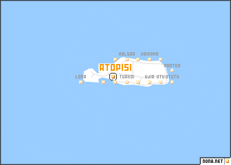
Atopisi (Fiji)Atopisi is a town in Fiji. An overview map of the region around Atopisi is displayed below.
regional and 3d topo map of Atopisi, Fiji ::
Nearby towns ::
Niutoto (0.0km north) //
Feavai (0.0km north) //
Feavarere (0.0km north) //
Lau (0.0km north) //
Tia (1.9km north) //
Poiva (1.9km north) //
Ahau (1.9km north) //
Mofmanu (1.8km west) //
Fapufa (1.8km west) //
Tuakoi (1.8km east) //
Saolei (1.8km east) //
Raksawa (1.8km east) //
Motusa (1.8km west) //
Lopo (2.6km north west) //
Upu (2.6km north west) //
Maftoa (2.6km north west) //
Keua (2.6km north west) //
Itumuta (2.6km north west) //
Juju (3.6km east) //
Haga (3.6km east) //
Saukama (3.6km east) //
Tuai (3.6km east) //
Jolmea (3.7km north) //
Hofvea (4.1km north east) //
Salvaka (4.1km north east) //
Malsaʼa (4.1km north east) //
Tamura (4.1km north east) //
Elsio (4.1km north east) //
Mea (4.1km north east) //
[all distances 'as the bird flies' and approximate] 
Disclaimer :: Information on this page comes without warranty of any kind |
||
|
Where is Atopisi? Elevation and coordinates ::
Latitude (lat): 12°31'0"S Longitude (lon): 177°3'0"E
Elevation (approx.): -32768m (map arrows pan, magnifying glasses zoom) |
||
|
Visiting Atopisi? Hotel/Accommodation ::
Book a hotel in Atopisi Travel Guide ::
Buy a travel guide for Fiji rental cars ::
car rental offers GPS waypoint ::
download a GPX waypoint (PoI) of Atopisi for your GPS receiver
|
||