|
search place name
|
||
Janneh Kunda (Lower River, Gambia, The)Janneh Kunda is a town in the Lower River region of Gambia, The. An overview map of the region around Janneh Kunda is displayed below.
regional and 3d topo map of Janneh Kunda, Gambia, The ::

Janneh Kunda airports ::
The nearest airport is BJL - Banjul Intl, located 55.9 km west of Janneh Kunda.
Other airports nearby include KLC - Kaolack (85.3 km north), ZIG - Ziguinchor (92.6 km south), CSK - Cap Skiring (126.0 km south west), BXO - Bissau Oswaldo Vieira Intl (172.6 km south), Nearby towns ::
Macca (2.3km north) //
Manar (2.8km south west) //
Karantaba (3.5km south west) //
Madina (4.4km south west) //
Wulumisa (4.7km north east) //
Juoli (5.1km north east) //
Kemoto (5.9km north) //
Kuyang (6.5km south east) //
Jula Kunda (6.9km south west) //
Santang Ba (7.1km south) //
Burrong (7.4km south west) //
Bantasu (7.8km south east) //
Tarburung Kotor (7.8km south west) //
Manduar (8.0km east) //
Kurang Kotor (8.2km south east) //
Gissay (9.4km south east) //
Missira Tenda (10.3km south west) //
[all distances 'as the bird flies' and approximate] 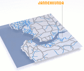 Places with similar names to Janneh Kunda, Gambia, The ::
// Jainākānda (BD)
// Jaynākānda (BD)
// Jīn Kandī (IR)
// Janeh Kunda (GM)
// Jane Kunda (GM)
// Gia Ngan Dưới (VN)
Disclaimer :: Information on this page comes without warranty of any kind |
||
|
Where is Janneh Kunda? Elevation and coordinates ::
Latitude (lat): 13°22'49"N Longitude (lon): 16°8'18"W
Elevation (approx.): 12m (map arrows pan, magnifying glasses zoom) |
||
|
Visiting Janneh Kunda? Hotel/Accommodation ::
Book a hotel in Janneh Kunda Travel Guide ::
Buy a travel guide for Gambia, The rental cars ::
car rental offers GPS waypoint ::
download a GPX waypoint (PoI) of Janneh Kunda for your GPS receiver
|
||