|
search place name
|
||
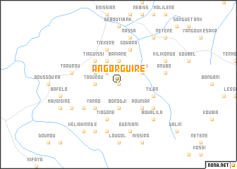
Angorguiré (Koundara, Guinea)Angorguiré is a town in the Koundara region of Guinea. An overview map of the region around Angorguiré is displayed below.
regional and 3d topo map of Angorguiré, Guinea ::
Angorguiré airports ::
The nearest airport is KGG - Kedougou, located 85.5 km east of Angorguiré.
Other airports nearby include LEK - Labe (128.2 km south east), TUD - Tambacounda (178.0 km north west), FIG - Fira Fria (224.2 km south), Nearby towns ::
Sandia (0.0km north) //
Loudal (2.6km north west) //
Borodji (3.7km south) //
Borodji Peul (3.7km south) //
Taourou (3.6km west) //
Epé (3.6km west) //
Baniané (3.7km north) //
Wanga (4.1km north east) //
Kanpaya (4.1km north west) //
Epita (4.1km north west) //
Pouniar (5.2km south east) //
Yarao (5.2km south west) //
Tiaguissi (5.2km north west) //
Tilan (5.7km east) //
Tiékéré (5.8km north) //
Gowara (5.8km north) //
Tiogoné (5.8km south) //
Bindougou (6.6km south east) //
Bouléré (6.6km south east) //
Gandiné (6.6km south west) //
Ouéniani (7.6km south) //
Tiankounbéré (7.6km south) //
Anubo (7.5km east) //
Nassa (7.6km north) //
Taourou (7.5km west) //
Bowal Ila (7.8km south east) //
Kogou Foulbé (8.3km south west) //
Tchaoung Ganguini (8.1km south west) //
Kilikondo (8.1km north east) //
[all distances 'as the bird flies' and approximate] 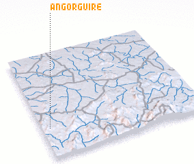 Places with similar names to Angorguiré, Guinea ::
// Ankirikiry (MG)
// Āngārgāra (BD)
Disclaimer :: Information on this page comes without warranty of any kind |
||
|
Where is Angorguiré? Elevation and coordinates ::
Latitude (lat): 12°17'0"N Longitude (lon): 12°57'0"W
Elevation (approx.): 168m (map arrows pan, magnifying glasses zoom) |
||
|
Visiting Angorguiré? Hotel/Accommodation ::
Book a hotel in Angorguiré Travel Guide ::
Buy a travel guide for Guinea rental cars ::
car rental offers GPS waypoint ::
download a GPX waypoint (PoI) of Angorguiré for your GPS receiver
|
||