|
search place name
|
||
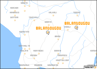
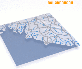
Balandougou (Boffa, Guinea)Balandougou is a town in the Boffa region of Guinea. An overview map of the region around Balandougou is displayed below.
regional and 3d topo map of Balandougou, Guinea ::
Balandougou airports ::
The nearest airport is FIG - Fira Fria, located 87.3 km east of Balandougou.
Other airports nearby include BXO - Bissau Oswaldo Vieira Intl (221.3 km north west), FNA - Freetown Lungi (230.9 km south east), Nearby towns ::
 Places with similar names to Balandougou, Guinea ::
// Balindog (PH)
// Blandikow (DE)
// Bilindik (TR)
// Balandagou (BF)
// Balandugu (SL)
// Balandougou (GN)
// Balandougou (GN)
// Balandougou (GN)
// Balandougou (GN)
// Balandougou (GN)
Disclaimer :: Information on this page comes without warranty of any kind |
||
|
Where is Balandougou? Elevation and coordinates ::
Latitude (lat): 10°21'0"N Longitude (lon): 14°22'0"W
Elevation (approx.): 52m (map arrows pan, magnifying glasses zoom) |
||
|
Visiting Balandougou? Hotel/Accommodation ::
Book a hotel in Balandougou Travel Guide ::
Buy a travel guide for Guinea rental cars ::
car rental offers GPS waypoint ::
download a GPX waypoint (PoI) of Balandougou for your GPS receiver
|
||