|
search place name
|
||
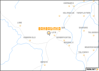
Bambadinka (Kouroussa, Guinea)Bambadinka is a town in the Kouroussa region of Guinea. An overview map of the region around Bambadinka is displayed below.
regional and 3d topo map of Bambadinka, Guinea ::
Bambadinka airports ::
The nearest airport is FAA - Faranah, located 140.7 km south west of Bambadinka.
Nearby towns ::
Leya (1.8km east) //
Sabokoroda (4.1km north east) //
Sembafagatou (5.8km east) //
Kobarakolo (7.5km west) //
Banisiraïla (8.3km north east) //
Bogo Oulé (8.2km south east) //
Kolinségué (10.4km north east) //
[all distances 'as the bird flies' and approximate]  Places with similar names to Bambadinka, Guinea ::
// Boumtenga (BF)
// Bambodanga (CD)
// Bambadinga (GN)
// Bamba Dinka (GN)
// Ba Ma Dang (VN)
// Bomteng (CM)
// Baimadang (CN)
// Bomutang (CN)
// Bambadinca (GW)
// Bambadinca (GW)
Disclaimer :: Information on this page comes without warranty of any kind |
||
|
Where is Bambadinka? Elevation and coordinates ::
Latitude (lat): 11°4'0"N Longitude (lon): 10°1'0"W
Elevation (approx.): 473m (map arrows pan, magnifying glasses zoom) |
||
|
Visiting Bambadinka? Hotel/Accommodation ::
Book a hotel in Bambadinka Travel Guide ::
Buy a travel guide for Guinea rental cars ::
car rental offers GPS waypoint ::
download a GPX waypoint (PoI) of Bambadinka for your GPS receiver
|
||