|
search place name
|
||
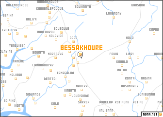
Bessakhouré (Forécariah, Guinea)Bessakhouré is a town in the Forécariah region of Guinea. An overview map of the region around Bessakhouré is displayed below.
regional and 3d topo map of Bessakhouré, Guinea ::
Bessakhouré airports ::
The nearest airport is FNA - Freetown Lungi, located 76.1 km south of Bessakhouré.
Other airports nearby include FIG - Fira Fria (132.8 km north west), Nearby towns ::
Farmoréya (1.3km south west) //
Aliya (1.8km west) //
Taïgbé (2.5km south west) //
Dansaya (3.1km north west) //
Dara (4.3km north west) //
Fouroudougou (4.9km north west) //
Tamagalidi (5.6km south west) //
Maliguiagbé (5.9km south west) //
Morébaya (5.9km west) //
Mahéra (7.2km south) //
Kolayire (7.2km north west) //
Fodia (7.3km east) //
Bouboudé (7.5km north west) //
Douadou (7.5km west) //
Kabaya (8.6km south) //
Dentédi (9.0km south west) //
Daboya (9.2km south west) //
Manfourou (9.6km north west) //
Kalékhouré (11.3km north west) //
[all distances 'as the bird flies' and approximate] 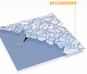 Places with similar names to Bessakhouré, Guinea ::
// Bās Kheria (IN)
// Biskohar (IN)
Disclaimer :: Information on this page comes without warranty of any kind |
||
|
Where is Bessakhouré? Elevation and coordinates ::
Latitude (lat): 9°16'54"N Longitude (lon): 13°1'1"W
Elevation (approx.): 32m (map arrows pan, magnifying glasses zoom) |
||
|
Visiting Bessakhouré? Hotel/Accommodation ::
Book a hotel in Bessakhouré Travel Guide ::
Buy a travel guide for Guinea rental cars ::
car rental offers GPS waypoint ::
download a GPX waypoint (PoI) of Bessakhouré for your GPS receiver
|
||