|
search place name
|
||
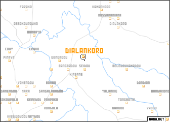
Dialankoro (Kissidougou, Guinea)Dialankoro is a town in the Kissidougou region of Guinea. An overview map of the region around Dialankoro is displayed below.
regional and 3d topo map of Dialankoro, Guinea ::
Dialankoro airports ::
The nearest airport is FAA - Faranah, located 119.9 km north west of Dialankoro.
Nearby towns ::
Seidou (1.9km south) //
Kirsané (4.1km south west) //
Bangbadou (4.1km south west) //
Dendadou (5.5km west) //
Bambaforia (7.5km west) //
Bamba (9.2km south west) //
Yalankié (9.2km south east) //
Sangalabadou (10.4km south west) //
Dialakoro (10.4km north east) //
[all distances 'as the bird flies' and approximate]  Places with similar names to Dialankoro, Guinea ::
// Talanquera (PA)
// Dolni Kray (BG)
// Dealu Negru (RO)
// Dealu Negru (RO)
// Tall Naqqār (IQ)
// Dūlānqīr (IR)
// Dalinagar (BD)
// Dilnagar (BD)
// Telinagar (BD)
// Telinougar (TD)
Disclaimer :: Information on this page comes without warranty of any kind |
||
|
Where is Dialankoro? Elevation and coordinates ::
Latitude (lat): 9°18'0"N Longitude (lon): 9°58'0"W
Elevation (approx.): 520m (map arrows pan, magnifying glasses zoom) |
||
|
Visiting Dialankoro? Hotel/Accommodation ::
Book a hotel in Dialankoro Travel Guide ::
Buy a travel guide for Guinea rental cars ::
car rental offers GPS waypoint ::
download a GPX waypoint (PoI) of Dialankoro for your GPS receiver
|
||