|
search place name
|
||
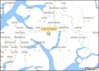
Kannbof (Boké, Guinea)Kannbof is a town in the Boké region of Guinea. An overview map of the region around Kannbof is displayed below.
regional and 3d topo map of Kannbof, Guinea ::
Kannbof airports ::
The nearest airport is BXO - Bissau Oswaldo Vieira Intl, located 121.7 km north west of Kannbof.
Other airports nearby include FIG - Fira Fria (166.6 km south east), ZIG - Ziguinchor (221.8 km north west), CSK - Cap Skiring (249.1 km north west), Nearby towns ::
Cacoca (2.6km north west) //
Caianticó (3.7km north) //
Tubadim (4.1km north west) //
Sonhèdabom (4.1km north east) //
Candarifom (5.2km south west) //
Cassafo (5.8km west) //
Caumãne (5.8km west) //
Caussara (5.8km north) //
Kabougani (5.8km east) //
Cunfa (5.8km north) //
Candefo (6.6km south west) //
Kabakoulonto (6.6km south east) //
Cassèfunda (6.6km north west) //
Sansalé (6.6km north east) //
Darsalame (7.4km north) //
Campreno Biafada (7.4km north) //
Cã Bras (7.5km west) //
Saliquinhé (7.6km north) //
Campreno Nalu (7.6km north) //
Tade (7.8km south west) //
Kabako (9.2km south east) //
Cassaprica (10.4km south west) //
[all distances 'as the bird flies' and approximate] 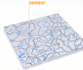 Places with similar names to Kannbof, Guinea ::
// Guénibafé (ML)
Disclaimer :: Information on this page comes without warranty of any kind |
||
|
Where is Kannbof? Elevation and coordinates ::
Latitude (lat): 11°5'0"N Longitude (lon): 14°54'0"W
Elevation (approx.): 5m (map arrows pan, magnifying glasses zoom) |
||
|
Visiting Kannbof? Hotel/Accommodation ::
Book a hotel in Kannbof Travel Guide ::
Buy a travel guide for Guinea rental cars ::
car rental offers GPS waypoint ::
download a GPX waypoint (PoI) of Kannbof for your GPS receiver
|
||