|
search place name
|
||
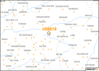
Koboya (Macenta, Guinea)Koboya is a town in the Macenta region of Guinea. An overview map of the region around Koboya is displayed below.
regional and 3d topo map of Koboya, Guinea ::
Koboya airports ::
The nearest airport is FAA - Faranah, located 175.8 km north west of Koboya.
Nearby towns ::
Teguebeya (2.1km south west) //
Kouzezou (2.3km south) //
Koèlazou (3.7km south west) //
Bokoézia (4.1km south west) //
Sougouroou (4.4km south east) //
Fauréa (4.8km north west) //
Darazou (5.1km south) //
Logbo (5.1km east) //
Kaizoma (5.2km south) //
Bétéorama (5.2km east) //
Kolimaï (5.7km south west) //
Likonoba (5.8km south west) //
Némèa (5.8km west) //
Yarakambaria (6.3km north) //
Sankirissa (6.5km north west) //
Sérissou (6.9km south west) //
Ouantanka (6.9km west) //
Féloussia (7.4km south west) //
Bézégréga (7.5km south west) //
Fassaziazou (7.7km south west) //
Bakouma (7.8km north east) //
Vonnéssou (8.7km south) //
Sampouyara (8.6km east) //
Boyda (9.0km south east) //
Bamalassou (9.3km south west) //
Bouldavourou (10.6km south west) //
Sogbao (10.6km south west) //
[all distances 'as the bird flies' and approximate] 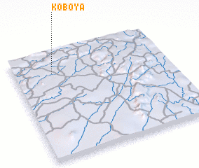 Places with similar names to Koboya, Guinea ::
Disclaimer :: Information on this page comes without warranty of any kind |
||
|
Where is Koboya? Elevation and coordinates ::
Latitude (lat): 8°48'49"N Longitude (lon): 9°44'44"W
Elevation (approx.): 612m (map arrows pan, magnifying glasses zoom) |
||
|
Visiting Koboya? Hotel/Accommodation ::
Book a hotel in Koboya Travel Guide ::
Buy a travel guide for Guinea rental cars ::
car rental offers GPS waypoint ::
download a GPX waypoint (PoI) of Koboya for your GPS receiver
|
||