|
search place name
|
||
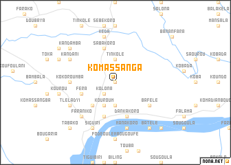
Komassanga (Guinea)Komassanga is a town in Guinea. An overview map of the region around Komassanga is displayed below.
regional and 3d topo map of Komassanga, Guinea ::
Komassanga airports ::
The nearest airport is BKO - Bamako Senou, located 173.5 km north east of Komassanga.
Other airports nearby include FAA - Faranah (240.2 km south west), Nearby towns ::
Missala (0.0km north) //
Kolona (2.6km south west) //
Fadiogola (3.7km south) //
Tinkolé (3.7km north) //
Kouroum (4.1km south west) //
Saint-Alexis (5.2km south west) //
Féra (5.8km west) //
Dankakoro (5.8km south) //
Sabakoro (5.8km north) //
Banankoro (5.8km south) //
Bafélé (6.6km south east) //
Kokoroumba (7.3km west) //
Manakoro (7.6km south) //
Kéda (7.6km north) //
Faraniko (7.8km south west) //
Siguiri (8.3km south west) //
Somonobougou (8.3km south west) //
Tleladyi (8.2km south west) //
Kandani (8.2km north west) //
Batélé (9.2km south east) //
Kandamba (9.1km north west) //
Danka Koura (10.4km south east) //
Tabako (10.4km south west) //
[all distances 'as the bird flies' and approximate] 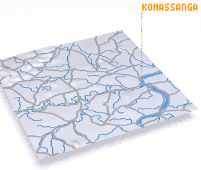 Places with similar names to Komassanga, Guinea ::
// Queimasangue (BR)
// Kamocinek (PL)
// Kumasinka (RU)
// Gombe-Isongo (CD)
// Kamba-Sengo (CD)
// Kamusenga (CD)
// Kamusenga (CD)
// Komsing (IN)
// Kamsango (GH)
// Gua Musang (MY)
Disclaimer :: Information on this page comes without warranty of any kind |
||
|
Where is Komassanga? Elevation and coordinates ::
Latitude (lat): 11°29'0"N Longitude (lon): 9°8'0"W
Elevation (approx.): 394m (map arrows pan, magnifying glasses zoom) |
||
|
Visiting Komassanga? Hotel/Accommodation ::
Book a hotel in Komassanga Travel Guide ::
Buy a travel guide for Guinea rental cars ::
car rental offers GPS waypoint ::
download a GPX waypoint (PoI) of Komassanga for your GPS receiver
|
||