|
search place name
|
||
Kourouma Daka (Guinea)Kourouma Daka is a town in Guinea. An overview map of the region around Kourouma Daka is displayed below.
regional and 3d topo map of Kourouma Daka, Guinea ::

Kourouma Daka airports ::
The nearest airport is BKO - Bamako Senou, located 186.5 km north east of Kourouma Daka.
Other airports nearby include FAA - Faranah (243.0 km south west), Nearby towns ::
Kosonia (3.7km south) //
Faro (3.7km north) //
Farabalé (4.1km north west) //
Malikia (5.4km east) //
Kiniéba (5.4km west) //
Moreya (5.8km south) //
Daniéni (6.6km south east) //
Moussondé Madla (7.4km north) //
Bendougou (8.1km north west) //
Faramankaya (8.1km south east) //
Foukourou (8.1km north east) //
Farinkamaya (9.1km south west) //
Sonsor Dala Farandé (9.2km north east) //
[all distances 'as the bird flies' and approximate] 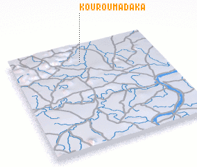 Places with similar names to Kourouma Daka, Guinea ::
// Gromadka (PL)
// Keur Madiké (MR)
// Keur Madiaka (SN)
// Karīm Dūk (IR)
// Karim Madaki (NG)
// Kérémédogo (ML)
// Kurumdek (PG)
// Garrymaddock (IE)
// Kermadec (FR)
// Gǝrmǝtük (AZ)
Disclaimer :: Information on this page comes without warranty of any kind |
||
|
Where is Kourouma Daka? Elevation and coordinates ::
Latitude (lat): 11°51'0"N Longitude (lon): 9°31'0"W
Elevation (approx.): 330m (map arrows pan, magnifying glasses zoom) |
||
|
Visiting Kourouma Daka? Hotel/Accommodation ::
Book a hotel in Kourouma Daka Travel Guide ::
Buy a travel guide for Guinea rental cars ::
car rental offers GPS waypoint ::
download a GPX waypoint (PoI) of Kourouma Daka for your GPS receiver
|
||