|
search place name
|
||
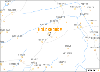
Molokhouré (Guinea)Molokhouré is a town in Guinea. An overview map of the region around Molokhouré is displayed below.
regional and 3d topo map of Molokhouré, Guinea ::
Molokhouré airports ::
The nearest airport is FIG - Fira Fria, located 66.2 km north west of Molokhouré.
Other airports nearby include FNA - Freetown Lungi (132.1 km south), LEK - Labe (202.9 km north east), Nearby towns ::
Koba (0.7km south east) //
Bangouya (2.4km east) //
Kouriya (3.8km south west) //
Bassika (4.2km north west) //
Yanguéya (4.5km north west) //
Bambaya (5.0km north) //
Kolakhouré (5.0km west) //
Niéguéya (7.3km north east) //
Moriyakhori (7.9km north east) //
Saliya (8.2km south east) //
Yataraya (9.8km south east) //
[all distances 'as the bird flies' and approximate] 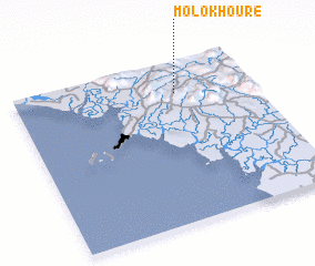 Places with similar names to Molokhouré, Guinea ::
// Māilākhor (BD)
// Mālākhera (IN)
// Mélikhouré (GN)
// Molokhouré (GN)
// Malikhor (PK)
// Melikhuri (SL)
Disclaimer :: Information on this page comes without warranty of any kind |
||
|
Where is Molokhouré? Elevation and coordinates ::
Latitude (lat): 9°48'15"N Longitude (lon): 13°19'19"W
Elevation (approx.): 187m (map arrows pan, magnifying glasses zoom) |
||
|
Visiting Molokhouré? Hotel/Accommodation ::
Book a hotel in Molokhouré Travel Guide ::
Buy a travel guide for Guinea rental cars ::
car rental offers GPS waypoint ::
download a GPX waypoint (PoI) of Molokhouré for your GPS receiver
|
||