|
search place name
|
||
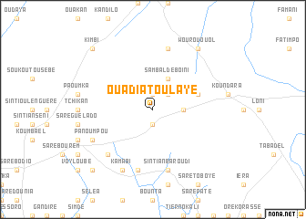
Ouadiatoulaye (Koundara, Guinea)Ouadiatoulaye is a town in the Koundara region of Guinea. An overview map of the region around Ouadiatoulaye is displayed below.
regional and 3d topo map of Ouadiatoulaye, Guinea ::
Ouadiatoulaye airports ::
The nearest airport is KGG - Kedougou, located 126.9 km east of Ouadiatoulaye.
Other airports nearby include TUD - Tambacounda (143.5 km north), LEK - Labe (173.8 km south east), Nearby towns ::
Doupou (1.9km north) //
Ipodou (1.9km south) //
Louguéré-Kéré (2.6km north east) //
Saré Aladji Tierno (3.6km east) //
Sambaldé Boïni (4.1km north east) //
Sambaldé (4.1km north east) //
Diamel (5.7km east) //
Mortordji (7.6km north) //
Sintiân Baroudi (7.6km south) //
Doukouréla (7.6km south) //
Gadalouguèl (7.6km south) //
Saré Abdoulaye (7.8km south west) //
Panoumpou (8.1km south west) //
Kamabi (8.2km south west) //
Wourou Ouol (9.2km north east) //
Sintiou Rou (9.2km north east) //
Kaporabina (10.4km north west) //
Kimbi (10.4km north west) //
Orévenndou (10.4km south west) //
Kangnéka (10.4km south west) //
[all distances 'as the bird flies' and approximate]  Places with similar names to Ouadiatoulaye, Guinea :: Disclaimer :: Information on this page comes without warranty of any kind |
||
|
Where is Ouadiatoulaye? Elevation and coordinates ::
Latitude (lat): 12°28'0"N Longitude (lon): 13°23'0"W
Elevation (approx.): 305m (map arrows pan, magnifying glasses zoom) |
||
|
Visiting Ouadiatoulaye? Hotel/Accommodation ::
Book a hotel in Ouadiatoulaye Travel Guide ::
Buy a travel guide for Guinea rental cars ::
car rental offers GPS waypoint ::
download a GPX waypoint (PoI) of Ouadiatoulaye for your GPS receiver
|
||