|
search place name
|
||
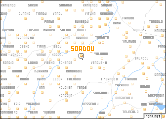
Soadou (Guékédou, Guinea)Soadou is a town in the Guékédou region of Guinea. An overview map of the region around Soadou is displayed below.
regional and 3d topo map of Soadou, Guinea ::
Soadou airports ::
The nearest airport is FAA - Faranah, located 162.7 km north of Soadou.
Nearby towns ::
Ouabingo (1.8km west) //
Moegbadou (2.6km south east) //
Koni (2.6km north east) //
Kpandu (3.7km north) //
Yenguema (4.1km south east) //
Kambadou (4.1km south west) //
Komendé (4.1km south west) //
Sandia (4.1km north east) //
Gbekpe (4.1km north east) //
Tongoma (4.1km north west) //
Bakodu (4.1km north west) //
Yalamba (4.2km east) //
Kolian (5.2km south east) //
Koloadou (5.2km north east) //
Dambo (5.2km north west) //
Kpeko (5.2km north west) //
Koardu (5.5km west) //
Kunte (5.6km north) //
Siounga (5.8km west) //
Dengedu (5.9km north) //
Faendou (5.9km south) //
Mano (5.8km west) //
Sedu (5.8km west) //
Kainkordu (5.9km north) //
Yendé To (5.9km north east) //
Yegbadou (6.6km south west) //
Dambadu (6.6km north west) //
Koardu (6.6km north west) //
Sufidu (6.7km north west) //
[all distances 'as the bird flies' and approximate] 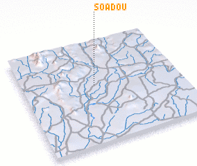 Places with similar names to Soadou, Guinea ::
Disclaimer :: Information on this page comes without warranty of any kind |
||
|
Where is Soadou? Elevation and coordinates ::
Latitude (lat): 8°35'0"N Longitude (lon): 10°32'0"W
Elevation (approx.): 374m (map arrows pan, magnifying glasses zoom) |
||
|
Visiting Soadou? Hotel/Accommodation ::
Book a hotel in Soadou Travel Guide ::
Buy a travel guide for Guinea rental cars ::
car rental offers GPS waypoint ::
download a GPX waypoint (PoI) of Soadou for your GPS receiver
|
||