|
search place name
|
||
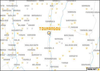
Toumandou (Guékédou, Guinea)Toumandou is a town in the Guékédou region of Guinea. An overview map of the region around Toumandou is displayed below.
regional and 3d topo map of Toumandou, Guinea ::
Toumandou airports ::
The nearest airport is FAA - Faranah, located 128.8 km north of Toumandou.
Nearby towns ::
Nimbakoro (3.8km south east) //
Yomandou (4.1km north) //
Sérèdou (4.2km south east) //
Dankouédou (5.2km south east) //
Kama (5.3km north east) //
Koumbélé (5.8km south) //
Loyan (6.7km south west) //
Konkoma (6.7km west) //
Kamian (7.2km west) //
Biricodou (7.3km east) //
Sindékoro (7.4km north) //
Oulako (7.8km north east) //
Bandadou (8.0km north west) //
Souloukoufa (8.1km south west) //
Lèlessa (8.8km east) //
Farandala (8.8km south east) //
Dorokoro (8.9km north) //
Follian (8.9km west) //
Sianfaran (9.2km north east) //
Dounamaro (9.3km south east) //
Koindou (9.3km south west) //
Oulako Doma (9.3km south east) //
Bourèdagadou (9.5km south) //
Kavia (9.6km north west) //
Ouassaya (9.7km south west) //
Kayso (10.6km north west) //
Sobadou (11.4km north east) //
[all distances 'as the bird flies' and approximate] 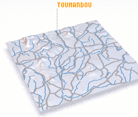 Places with similar names to Toumandou, Guinea ::
Disclaimer :: Information on this page comes without warranty of any kind |
||
|
Where is Toumandou? Elevation and coordinates ::
Latitude (lat): 8°54'32"N Longitude (lon): 10°28'23"W
Elevation (approx.): 413m (map arrows pan, magnifying glasses zoom) |
||
|
Visiting Toumandou? Hotel/Accommodation ::
Book a hotel in Toumandou Travel Guide ::
Buy a travel guide for Guinea rental cars ::
car rental offers GPS waypoint ::
download a GPX waypoint (PoI) of Toumandou for your GPS receiver
|
||