|
search place name
|
||
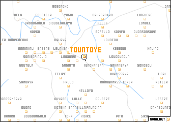
Tountoye (Dinguiraye, Guinea)Tountoye is a town in the Dinguiraye region of Guinea. An overview map of the region around Tountoye is displayed below.
regional and 3d topo map of Tountoye, Guinea ::
Tountoye airports ::
The nearest airport is LEK - Labe, located 156.4 km west of Tountoye.
Other airports nearby include FAA - Faranah (164.2 km south), KGG - Kedougou (188.0 km north west), Nearby towns ::
Kotomori (1.8km west) //
Iéro Kamban (2.6km south east) //
Linguéré (3.6km west) //
Fougoumba (3.6km east) //
Kessélia (4.1km north west) //
Téma (4.1km north west) //
Bagui (4.1km north west) //
Daguita (4.1km south west) //
Lé Lamba (5.8km west) //
Boubéré (5.8km west) //
Doubel (5.8km west) //
Fassalia (5.8km east) //
Lountou (6.6km north east) //
Balaya (6.6km north west) //
Fallo (6.6km south west) //
Téliré (6.6km south west) //
Ba Fello (6.6km north east) //
Lougouroun (7.3km east) //
Hellaya (7.4km south) //
Koulayabé (7.5km west) //
Kébégui (7.5km east) //
Sakambaya (7.5km east) //
Kamban Massi (7.8km south east) //
Fellé (8.3km north east) //
Diakissaya (8.2km south east) //
Bayégo (9.2km north west) //
Dioudé Balaya (9.2km north west) //
Karifa (9.1km north east) //
[all distances 'as the bird flies' and approximate]  Places with similar names to Tountoye, Guinea ::
Disclaimer :: Information on this page comes without warranty of any kind |
||
|
Where is Tountoye? Elevation and coordinates ::
Latitude (lat): 11°31'0"N Longitude (lon): 10°52'0"W
Elevation (approx.): 408m (map arrows pan, magnifying glasses zoom) |
||
|
Visiting Tountoye? Hotel/Accommodation ::
Book a hotel in Tountoye Travel Guide ::
Buy a travel guide for Guinea rental cars ::
car rental offers GPS waypoint ::
download a GPX waypoint (PoI) of Tountoye for your GPS receiver
|
||