|
search place name
|
||
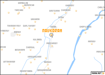
Navkoram ((( Kulyabskaya Oblast' )), Tajikistan)Navkoram is a town in the (( Kulyabskaya Oblast' )) region of Tajikistan. An overview map of the region around Navkoram is displayed below.
regional and 3d topo map of Navkoram, Tajikistan ::
Navkoram airports ::
The nearest airport is DYU - Dushanbe, located 34.1 km north west of Navkoram.
Other airports nearby include UND - Kunduz Konduz (180.4 km south), MZR - Mazar-i-sharif Mazar I Sharif (238.7 km south west), Nearby towns ::
Parchasoy (2.9km south) //
Yovan (2.9km north) //
Kulobod (4.5km west) //
Garav (5.8km north west) //
Ozodi (6.8km north) //
Beshbulok (6.8km north east) //
Dashtobod (7.5km south) //
Dakhana (7.4km north west) //
Dastgirak (8.7km north) //
Gurlyuk-Say (7.3km north west) //
Chorgul (7.6km south west) //
Chirakon (9.6km north east) //
Kangur-Dzhar (9.3km south west) //
Tagayobod (10.8km south west) //
[all distances 'as the bird flies' and approximate] 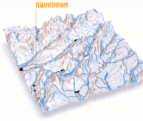 Places with similar names to Navkoram, Tajikistan ::
Disclaimer :: Information on this page comes without warranty of any kind |
||
|
Where is Navkoram? Elevation and coordinates ::
Latitude (lat): 38°17'13"N Longitude (lon): 69°2'28"E
Elevation (approx.): 633m (map arrows pan, magnifying glasses zoom) |
||
|
Visiting Navkoram? Hotel/Accommodation ::
Book a hotel in Navkoram Travel Guide ::
Buy a travel guide for Tajikistan rental cars ::
car rental offers GPS waypoint ::
download a GPX waypoint (PoI) of Navkoram for your GPS receiver
|
||