|
search place name
|
||
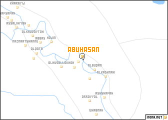
Abū Ḩasan (Dayr az Zawr, Syria)Abū Ḩasan is a town in the Dayr az Zawr region of Syria. An overview map of the region around Abū Ḩasan is displayed below.
regional and 3d topo map of Abū Ḩasan, Syria ::
Abū Ḩasan airports ::
The nearest airport is DEZ - Deire Zor Deir Zzor, located 96.1 km north west of Abū Ḩasan.
Nearby towns ::
Al Burham (1.2km west) //
Ar Ramādī (2.4km south west) //
Al Buq‘ān (3.0km south east) //
Al Ḩasrāt (4.3km south) //
Al Musallakhah (4.5km west) //
Al Kashmah (5.4km south east) //
Hajīn (7.2km north west) //
Ash Sha‘fah (9.1km south east) //
[all distances 'as the bird flies' and approximate] 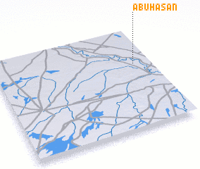 Places with similar names to Abū Ḩasan, Syria ::
Disclaimer :: Information on this page comes without warranty of any kind |
||
|
Where is Abū Ḩasan? Elevation and coordinates ::
Latitude (lat): 34°39'12"N Longitude (lon): 40°53'43"E
Elevation (approx.): 179m (map arrows pan, magnifying glasses zoom) |
||
|
Visiting Abū Ḩasan? Hotel/Accommodation ::
Book a hotel in Abū Ḩasan Travel Guide ::
Buy a travel guide for Syria rental cars ::
car rental offers GPS waypoint ::
download a GPX waypoint (PoI) of Abū Ḩasan for your GPS receiver
|
||