|
search place name
|
||
Al Batrāʼ (Al Ḩasakah, Syria)Al Batrāʼ is a town in the Al Ḩasakah region of Syria. An overview map of the region around Al Batrāʼ is displayed below.
regional and 3d topo map of Al Batrāʼ, Syria ::

Al Batrāʼ airports ::
The nearest airport is BAL - Batman, located 136.0 km north west of Al Batrāʼ.
Other airports nearby include VAN - Van (186.3 km north east), DIY - Diyabakir Diyarbakir (199.4 km north west), Nearby towns ::
Khirbat al Wālid (2.2km west) //
Al Ḩammām (2.6km south west) //
Umm at Tulūl (3.6km south east) //
Sharm ash Shaykh (5.5km north) //
Abū Qīr (5.2km north west) //
Ḩammāmuk (6.4km south) //
Tall Khinzīr Fawqānī (6.7km south) //
Mallā Marsah Kabīr (6.0km north east) //
Ţulayfah (5.7km west) //
Yāfā (7.0km north) //
Suwaydik (7.3km north) //
Tall Khinzīr Taḩtānī (7.4km south) //
Ar Rashīdīyah (7.7km north) //
Mallā Marsah Şaghīr (6.7km north east) //
Kāratshān (8.0km north west) //
Kīrak (9.0km north) //
Ḩājjī Hārūn (8.6km north east) //
Ḩannāwīyah (8.2km north west) //
Ash Shāmīyah (9.1km north west) //
Qal‘at al Ḩişn (9.7km south east) //
Al Hāmah (9.6km north east) //
Mawzālān (9.7km north east) //
[all distances 'as the bird flies' and approximate] 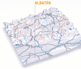 Places with similar names to Al Batrāʼ, Syria ::
Disclaimer :: Information on this page comes without warranty of any kind |
||
|
Where is Al Batrāʼ? Elevation and coordinates ::
Latitude (lat): 37°3'15"N Longitude (lon): 42°11'37"E
Elevation (approx.): 607m (map arrows pan, magnifying glasses zoom) |
||
|
Visiting Al Batrāʼ? Hotel/Accommodation ::
Book a hotel in Al Batrāʼ Travel Guide ::
Buy a travel guide for Syria rental cars ::
car rental offers GPS waypoint ::
download a GPX waypoint (PoI) of Al Batrāʼ for your GPS receiver
|
||