|
search place name
|
||
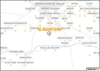
Al Buwayḑah (Dimashq, Syria)Al Buwayḑah is a town in the Dimashq region of Syria. An overview map of the region around Al Buwayḑah is displayed below.
regional and 3d topo map of Al Buwayḑah, Syria ::
Al Buwayḑah airports ::
The nearest airport is DAM - Damascus Intl, located 18.4 km east of Al Buwayḑah.
Other airports nearby include RPN - Rosh Pina Mahanaim I Ben Yaakov (84.6 km south west), BEY - Beirut Rafic Hariri Intl (89.0 km north west), OMF - Mafraq King Hussein (117.7 km south), HFA - Haifa (136.6 km south west), Nearby towns ::
Qabr as Sitt (2.4km north east) //
Yaldā (3.7km north) //
Ḩawsh al Baḩdalīyah (3.6km north east) //
Ḩawsh ar Rayḩānīyah (3.6km north west) //
Subaynah al Kabīrah (3.6km north west) //
Subaynah aş Şaghīrah (4.8km north west) //
Bāb Bīlā (5.6km north) //
‘Aqrabā (5.8km north) //
‘Ādilīyah (5.8km south) //
Bayt Saḩam (5.8km north) //
Ḩirjillah (5.8km south) //
Ḩawsh ash Sha‘īr (5.0km east) //
Al Qadam (6.4km north west) //
Najhah (5.9km south east) //
Mukhayyam al Yarmūk (7.4km north) //
Ḩawsh Sulţān (6.5km east) //
Ḩawsh al Balās (6.5km west) //
Balāţ (7.2km north east) //
Ḩawsh al Qadam (8.0km north east) //
Jaramānah (8.0km north east) //
Shab‘ā (7.2km north east) //
Maydān (8.0km north west) //
Dārayyā (7.2km north west) //
Kafr Sūsah (8.7km north west) //
Al Mulayḩah (8.7km north east) //
Dayr Baḩdal (8.7km north east) //
Hadisset al Jarash (9.7km north east) //
Zabdīn (9.7km north east) //
[all distances 'as the bird flies' and approximate] 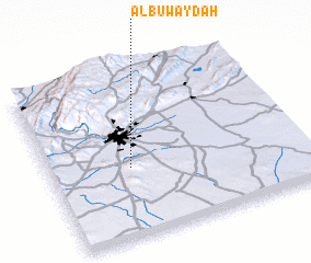 Places with similar names to Al Buwayḑah, Syria ::
// Al Bawīţī (EG)
// Al Buwaţah (SA)
// Al Buwayḑah (SD)
// Al Buwayḑah (SD)
// Al Buwayḑah (SD)
// Al Buwayḑah (JO)
// Al Buwayḑ (SY)
// Al Buwayḑah (SY)
// Al Buwayḑah (SY)
// Al Buwayḑah (SY)
Disclaimer :: Information on this page comes without warranty of any kind |
||
|
Where is Al Buwayḑah? Elevation and coordinates ::
Latitude (lat): 33°25'0"N Longitude (lon): 36°19'0"E
Elevation (approx.): 661m (map arrows pan, magnifying glasses zoom) |
||
|
Visiting Al Buwayḑah? Hotel/Accommodation ::
Book a hotel in Al Buwayḑah Travel Guide ::
Buy a travel guide for Syria rental cars ::
car rental offers GPS waypoint ::
download a GPX waypoint (PoI) of Al Buwayḑah for your GPS receiver
|
||