|
search place name
|
||
Al Marjah (Al Ḩasakah, Syria)Al Marjah is a town in the Al Ḩasakah region of Syria. An overview map of the region around Al Marjah is displayed below.
regional and 3d topo map of Al Marjah, Syria ::

Al Marjah airports ::
The nearest airport is BAL - Batman, located 130.7 km north west of Al Marjah.
Other airports nearby include DIY - Diyabakir Diyarbakir (188.2 km north west), VAN - Van (203.1 km north east), DEZ - Deire Zor Deir Zzor (249.1 km south west), Nearby towns ::
Rumaylān ash Shaykh (1.8km south west) //
Kharāb Bunyān (1.8km south east) //
Khirbat ‘Abbās (2.4km north) //
As Sa‘īdah ‘Amqūn (2.2km north east) //
Kharāb Abū Ghālib aş Şubḩīyah (3.5km south) //
Shuwayrah (3.2km north east) //
Rumaylān Bāshā (4.2km south west) //
At Tallayn (5.4km north) //
‘Arūr (5.9km north east) //
Al Yūsufīyah (6.3km south west) //
Tall Ghazāl (6.5km south east) //
Tall Jammāl (7.8km north) //
Tall Fakhkhār (7.7km north) //
TallḐayyiq (6.7km east) //
Abū Ḩajar (8.8km south) //
Al Junaydīyah (9.2km south west) //
Aş Şihrīj al Gharbī (8.8km south east) //
Ḩamdān (8.6km north east) //
Al ‘Ulyānīyah (9.8km south east) //
Tall az Ziyārāt (10.4km north east) //
[all distances 'as the bird flies' and approximate] 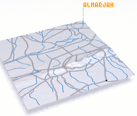 Places with similar names to Al Marjah, Syria ::
Disclaimer :: Information on this page comes without warranty of any kind |
||
|
Where is Al Marjah? Elevation and coordinates ::
Latitude (lat): 36°58'47"N Longitude (lon): 41°59'30"E
Elevation (approx.): 430m (map arrows pan, magnifying glasses zoom) |
||
|
Visiting Al Marjah? Hotel/Accommodation ::
Book a hotel in Al Marjah Travel Guide ::
Buy a travel guide for Syria rental cars ::
car rental offers GPS waypoint ::
download a GPX waypoint (PoI) of Al Marjah for your GPS receiver
|
||