|
search place name
|
||
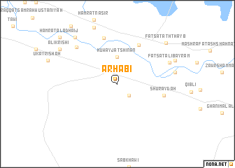
Arḩabī (Ar Raqqah, Syria)Arḩabī is a town in the Ar Raqqah region of Syria. An overview map of the region around Arḩabī is displayed below.
regional and 3d topo map of Arḩabī, Syria ::
Arḩabī airports ::
The nearest airport is DEZ - Deire Zor Deir Zzor, located 103.8 km south east of Arḩabī.
Other airports nearby include PMS - Palmyra (162.7 km south west), GZT - Gaziantep Oguzeli (201.3 km north west), Nearby towns ::
As Sabkhah (2.4km south east) //
Ḩuwayjat Shinān (4.3km north) //
Faţsat al Kusūn (6.8km north east) //
Ḩamrat Balāsim (7.5km north) //
Shuraydah (6.3km east) //
Dalḩah (7.9km north west) //
Faţsat ‘Alī Bayram (7.6km north east) //
Ḩamrat Jamāsī (9.2km north west) //
Faţsat ath Thayb (9.0km north east) //
[all distances 'as the bird flies' and approximate]  Places with similar names to Arḩabī, Syria ::
// Ar Rāhib (EG)
// Ar Riḩāb (SA)
// Ar Raḩab (SD)
// Ar Rahèba (LY)
// Arḩāb (SY)
// Ar Rāhib (SY)
// Ar Ruḩaybah (SY)
// Ar Ruḩaybah (SY)
// Ar Raḩabah (YE)
// Ar Hob (CN)
Disclaimer :: Information on this page comes without warranty of any kind |
||
|
Where is Arḩabī? Elevation and coordinates ::
Latitude (lat): 35°49'0"N Longitude (lon): 39°14'0"E
Elevation (approx.): 314m (map arrows pan, magnifying glasses zoom) |
||
|
Visiting Arḩabī? Hotel/Accommodation ::
Book a hotel in Arḩabī Travel Guide ::
Buy a travel guide for Syria rental cars ::
car rental offers GPS waypoint ::
download a GPX waypoint (PoI) of Arḩabī for your GPS receiver
|
||