|
search place name
|
||
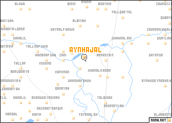
‘Ayn Ḩajal (Ḩimş, Syria)‘Ayn Ḩajal is a town in the Ḩimş region of Syria. An overview map of the region around ‘Ayn Ḩajal is displayed below.
regional and 3d topo map of ‘Ayn Ḩajal, Syria ::
‘Ayn Ḩajal airports ::
The nearest airport is LTK - Latakia Bassel Al Assad Intl, located 86.8 km north west of ‘Ayn Ḩajal.
Other airports nearby include ALP - Aleppo Intl (148.5 km north), PMS - Palmyra (153.8 km east), BEY - Beirut Rafic Hariri Intl (164.3 km south west), DAM - Damascus Intl (167.6 km south), Nearby towns ::
Ghajar al Amīr (1.8km south west) //
Jarjīsah (2.4km north west) //
Tūmīn (3.0km north east) //
Khirbat Buzliyā (3.1km north west) //
Ḩurbinafsuh (3.4km north west) //
Ar Rastan (3.6km east) //
Khān al Ma‘şar (4.0km south east) //
Zāri‘ (4.1km west) //
Ḩurr Binafsah (4.6km north west) //
Umm Sharshūḩ (5.3km south) //
Khān Kafr Jālī (5.1km south east) //
Kafr Nān (5.3km south west) //
Dayr al Fardīs (7.1km north west) //
Al Bīyah (7.8km north) //
Tasnīn (7.1km south west) //
As Suwaydah (8.0km north) //
Zawr al ‘Āshiq (6.9km east) //
Ḩarb Nafsah (7.1km west) //
Qanāyah (8.2km south west) //
Az Za‘farānah (7.4km south east) //
Kissine (7.3km west) //
Murayj ad Durr (7.7km north east) //
Ghawr al ‘Āşī (7.7km north east) //
[all distances 'as the bird flies' and approximate]  Places with similar names to ‘Ayn Ḩajal, Syria :: Disclaimer :: Information on this page comes without warranty of any kind |
||
|
Where is ‘Ayn Ḩajal? Elevation and coordinates ::
Latitude (lat): 34°54'50"N Longitude (lon): 36°41'40"E
Elevation (approx.): 418m (map arrows pan, magnifying glasses zoom) |
||
|
Visiting ‘Ayn Ḩajal? Hotel/Accommodation ::
Book a hotel in ‘Ayn Ḩajal Travel Guide ::
Buy a travel guide for Syria rental cars ::
car rental offers GPS waypoint ::
download a GPX waypoint (PoI) of ‘Ayn Ḩajal for your GPS receiver
|
||