|
search place name
|
||
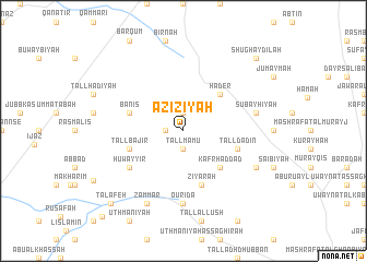
‘Azīzīyah (Ḩalab, Syria)‘Azīzīyah is a town in the Ḩalab region of Syria. An overview map of the region around ‘Azīzīyah is displayed below.
regional and 3d topo map of ‘Azīzīyah, Syria ::
‘Azīzīyah airports ::
The nearest airport is ALP - Aleppo Intl, located 31.7 km north east of ‘Azīzīyah.
Other airports nearby include LTK - Latakia Bassel Al Assad Intl (114.3 km south west), GZT - Gaziantep Oguzeli (118.2 km north), ADA - Adana Incirlik Ab (184.3 km north west), ADA - Adana (193.2 km north west), Nearby towns ::
Tulaylāt (1.9km north) //
Tall Māmū (1.9km south) //
Makḩalah (1.9km south) //
Maryūdah (1.5km west) //
Hâder (4.8km north east) //
Kafr Ḩaddād (4.8km south east) //
Ziyārah (5.8km south) //
Tall Dādīn (4.9km east) //
Bāniş (4.9km west) //
Tall Bājir (4.9km west) //
Huwayyir (5.8km south west) //
Ourîda (7.4km south) //
Şubayḩīyah (6.3km east) //
Dulāmah (7.1km south east) //
Zammār (8.0km south) //
Shughaydilah (9.5km north east) //
Talâfeh (9.5km south west) //
Jallās (11.1km south west) //
[all distances 'as the bird flies' and approximate]  Places with similar names to ‘Azīzīyah, Syria ::
Disclaimer :: Information on this page comes without warranty of any kind |
||
|
Where is ‘Azīzīyah? Elevation and coordinates ::
Latitude (lat): 35°57'0"N Longitude (lon): 37°1'0"E
Elevation (approx.): 255m (map arrows pan, magnifying glasses zoom) |
||
|
Visiting ‘Azīzīyah? Hotel/Accommodation ::
Book a hotel in ‘Azīzīyah Travel Guide ::
Buy a travel guide for Syria rental cars ::
car rental offers GPS waypoint ::
download a GPX waypoint (PoI) of ‘Azīzīyah for your GPS receiver
|
||