|
search place name
|
||
Dayr Shumayyil at Taḩtānī (Ḩamāh, Syria)Dayr Shumayyil at Taḩtānī is a town in the Ḩamāh region of Syria. An overview map of the region around Dayr Shumayyil at Taḩtānī is displayed below.
regional and 3d topo map of Dayr Shumayyil at Taḩtānī, Syria ::

Dayr Shumayyil at Taḩtānī airports ::
The nearest airport is LTK - Latakia Bassel Al Assad Intl, located 42.8 km north west of Dayr Shumayyil at Taḩtānī.
Other airports nearby include ALP - Aleppo Intl (134.5 km north east), BEY - Beirut Rafic Hariri Intl (172.2 km south west), PMS - Palmyra (193.4 km east), DAM - Damascus Intl (199.1 km south), Nearby towns ::
As Salūqīyah (1.9km south) //
Mushāshin al Arman (1.5km east) //
Dayr Shumayyil al Fawqānī (1.5km west) //
Mashtá al Laqbah (3.7km south) //
Al Aalmîyé (3.6km north east) //
Al Julaymah (3.6km south east) //
Kanfū (3.6km south east) //
‘Ayn al Jurn (4.0km north) //
Aş Şārimīyah (4.8km north east) //
Al Khān (4.8km south east) //
Abū Qubays (4.8km north west) //
Ḩārat as Sarāyā (4.8km south west) //
Al Qurayyāt (4.8km south west) //
Blūtān (5.6km north) //
Al Muqaybirah (5.6km south) //
Al Jawbah (5.8km north) //
Abū Qubays (5.8km north) //
Tall Salḩab (5.8km north) //
Al Kanāʼis (4.9km west) //
Mashtá al Jawbah (5.8km south) //
Jalmīdūn (5.8km south) //
Al Kharāʼib (5.9km north west) //
Al Laqbah (6.3km south west) //
Ţayr Jubbah (5.9km south west) //
Jubb Ramlah (6.1km east) //
Jawbat Kalakh (7.4km south) //
Al Ḩidādah (7.6km north) //
Ḩayr Masīl (7.6km north) //
Bīrat al Jabal (7.1km north west) //
[all distances 'as the bird flies' and approximate] 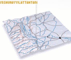 Places with similar names to Dayr Shumayyil at Taḩtānī, Syria :: Disclaimer :: Information on this page comes without warranty of any kind |
||
|
Where is Dayr Shumayyil at Taḩtānī? Elevation and coordinates ::
Latitude (lat): 35°12'0"N Longitude (lon): 36°21'0"E
Elevation (approx.): 234m (map arrows pan, magnifying glasses zoom) |
||
|
Visiting Dayr Shumayyil at Taḩtānī? Hotel/Accommodation ::
Book a hotel in Dayr Shumayyil at Taḩtānī Travel Guide ::
Buy a travel guide for Syria rental cars ::
car rental offers GPS waypoint ::
download a GPX waypoint (PoI) of Dayr Shumayyil at Taḩtānī for your GPS receiver
|
||