|
search place name
|
||
Duwaybiq (Ḩalab, Syria)Duwaybiq is a town in the Ḩalab region of Syria. An overview map of the region around Duwaybiq is displayed below.
regional and 3d topo map of Duwaybiq, Syria ::

Duwaybiq airports ::
The nearest airport is ALP - Aleppo Intl, located 41.2 km south of Duwaybiq.
Other airports nearby include GZT - Gaziantep Oguzeli (48.0 km north east), ADA - Adana Incirlik Ab (171.8 km west), LTK - Latakia Bassel Al Assad Intl (174.3 km south west), ADA - Adana (183.7 km west), Nearby towns ::
Dābiq (1.9km south) //
Iḩtaymilāt (2.2km north west) //
Arshāq (4.0km south) //
Baḩūrtah (3.5km north east) //
Shwīrīn (4.8km north east) //
Turkumān Bāriḩ (4.5km east) //
Ra‘īl (5.6km north) //
Ḩawār an Nahr (5.5km south) //
Murayghil (5.8km north) //
Şūrān (5.1km west) //
Jakkah (6.3km north east) //
Ţawghalī (6.6km north west) //
Yanī Yabān (7.4km north) //
Tilālayn (6.5km south west) //
Ţūghalī (7.4km north west) //
Akhtarīn (7.0km south east) //
Kadrīsh (7.0km north east) //
Ghayţūn (8.0km south) //
Sunbul (8.0km south) //
Al Ball (7.5km north west) //
Qizil Mazra‘ah (8.9km north) //
Şandarah (8.1km north east) //
Tall Sha‘īr (9.5km north east) //
[all distances 'as the bird flies' and approximate] 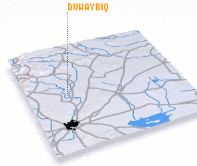
Disclaimer :: Information on this page comes without warranty of any kind |
||
|
Where is Duwaybiq? Elevation and coordinates ::
Latitude (lat): 36°33'0"N Longitude (lon): 37°16'0"E
Elevation (approx.): 450m (map arrows pan, magnifying glasses zoom) |
||
|
Visiting Duwaybiq? Hotel/Accommodation ::
Book a hotel in Duwaybiq Travel Guide ::
Buy a travel guide for Syria rental cars ::
car rental offers GPS waypoint ::
download a GPX waypoint (PoI) of Duwaybiq for your GPS receiver
|
||