|
search place name
|
||
Ḩarbul (Ḩalab, Syria)Ḩarbul is a town in the Ḩalab region of Syria. An overview map of the region around Ḩarbul is displayed below.
regional and 3d topo map of Ḩarbul, Syria ::

Ḩarbul airports ::
The nearest airport is ALP - Aleppo Intl, located 28.5 km south of Ḩarbul.
Other airports nearby include GZT - Gaziantep Oguzeli (63.5 km north east), LTK - Latakia Bassel Al Assad Intl (158.8 km south west), ADA - Adana Incirlik Ab (167.8 km north west), ADA - Adana (179.2 km west), Nearby towns ::
Biʼr aş Şabāḩ (2.4km south east) //
Qanfūz (3.0km west) //
Māri‘ (4.0km north) //
Ash Shaykh ‘Īsá (4.0km north) //
Ma‘arrat Umm al Ḩawsh (4.8km south east) //
Aḩraş (4.8km south west) //
Tall Mālid (6.0km east) //
Tall Qarāḩ (7.4km south) //
Mazra‘at al ‘Uyūn (6.2km east) //
Kafr Nāşiḩ (6.2km west) //
Zaytān al Maşna‘ (7.1km south west) //
Tall Rif‘at (7.0km north west) //
Tall Jabīn (8.3km south) //
Sunbul (8.2km north east) //
Waḩshīyah (8.7km south east) //
Misqān (8.2km south west) //
Ḩardatnīn (9.5km south west) //
Ḩawār an Nahr (10.6km north east) //
[all distances 'as the bird flies' and approximate] 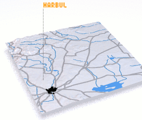 Places with similar names to Ḩarbul, Syria ::
Disclaimer :: Information on this page comes without warranty of any kind |
||
|
Where is Ḩarbul? Elevation and coordinates ::
Latitude (lat): 36°26'0"N Longitude (lon): 37°10'0"E
Elevation (approx.): 442m (map arrows pan, magnifying glasses zoom) |
||
|
Visiting Ḩarbul? Hotel/Accommodation ::
Book a hotel in Ḩarbul Travel Guide ::
Buy a travel guide for Syria rental cars ::
car rental offers GPS waypoint ::
download a GPX waypoint (PoI) of Ḩarbul for your GPS receiver
|
||